News and Events

We love to hear about your experience and see your photographs through the seasons. Don't forget to follow us on Facebook and share our pages. We know we've done a great job when you've had a fantastic day out!

GRIN WOODS BUTTERFLY SURVEY UPDATE

The first half of the butterfly recording season has been completed and Steve Orridge has sent us his interim report. (See below) The unsettled weather has meant that very few Butterflies have been recorded, but with the forecast for July showing signs of warmer settled weather, Steve is hopeful that numbers will improve.

If you are interested in taking part in the survey contact us at communications@buxtoncivicassociation.org.uk.

The full report can be read below.

Grin Woods Butterfly Transect interim report

Coal Mines

There are two coal seams in the high ground to the west of Burbage. One seam, known by various names of the years, including House Coal seam and Ringinglow seam, runs approximately north/south along the line of Burbage Edge and Axe Edge on the western side of the ridge with a steep dip towards the west. The other seam is an isolated seam around the headwaters of the river Goyt and it is known as the Goyt Coal seam.

Each of these seams was worked in the 18th and 19th century and in the 17th century to a lesser extent. Output from these small mines was taken from these isolated spots by packhorse along the local turnpikes and "coal roads" and later by a siding connected to the Cromford and High peak Railway (CHPR) that opened in 1831. Coal roads are recorded leading to Hartington, Chelmorton and Taddington. Coal transported via the siding was taken to Grin Low Quarry and Harpur Hill Quarry and so played an important part in the growth of the local lime burning industry.

The main centre of surface activity was near the Macclesfield Old Road. Level Lane led to the entrance to the Duke's Level, which still acts as the main drainage channel for the disused mine workings. Further up the Old Road and by footpaths leading from the Old Road along the western side of Axe Edge to Cisterns Clough, many other traces of the old mine workings can be seen.

These have been well described in a recent BCA publication entitled "A walking guide to Buxton' Coal Mines", which is available at Poole's Cavern (£2.50). A book "The Coal Mines of Buxton" by A F Roberts and J T Leach gives a more detailed description of the history and layout of the mines. The Goyt mine closed in 1898 while the House Coal workings moved steadily southwards to the Staffordshire border, with a drift tunnel at Cisterns Clough. These workings closed in 1921.

More Information On Buxton Coalfields

Burbage

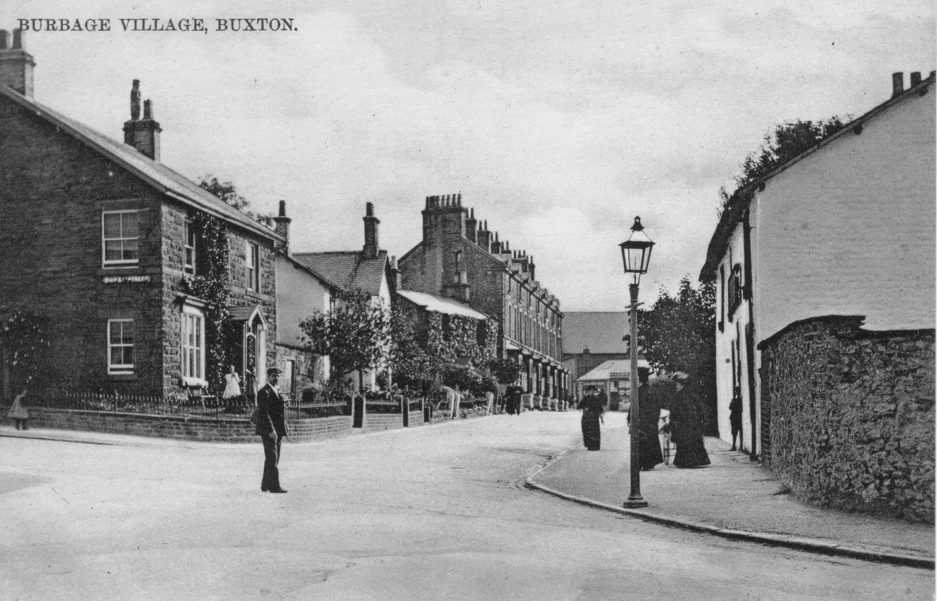
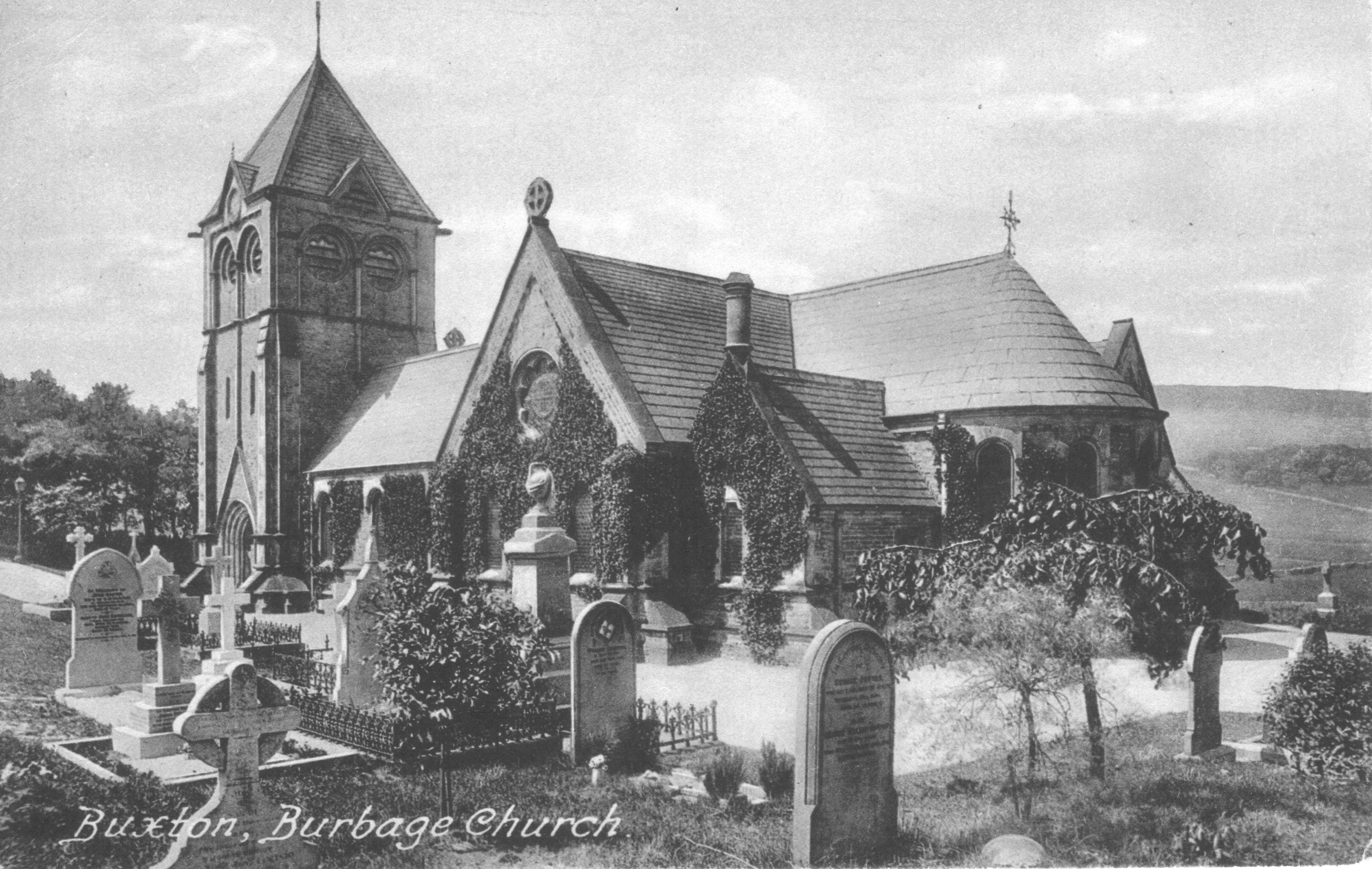
Burbage is situated on the western side of Buxton, where the main roads from Macclesfield and Leek approach the town. At the centre of the village, the church, the "Duke" public house, the village shop, a bowling green, Burbage Band's band hut and the Burbage Institute are clustered together within a few yards of one another. The village school was formerly located in this area before moving to new premises in the 1960s.

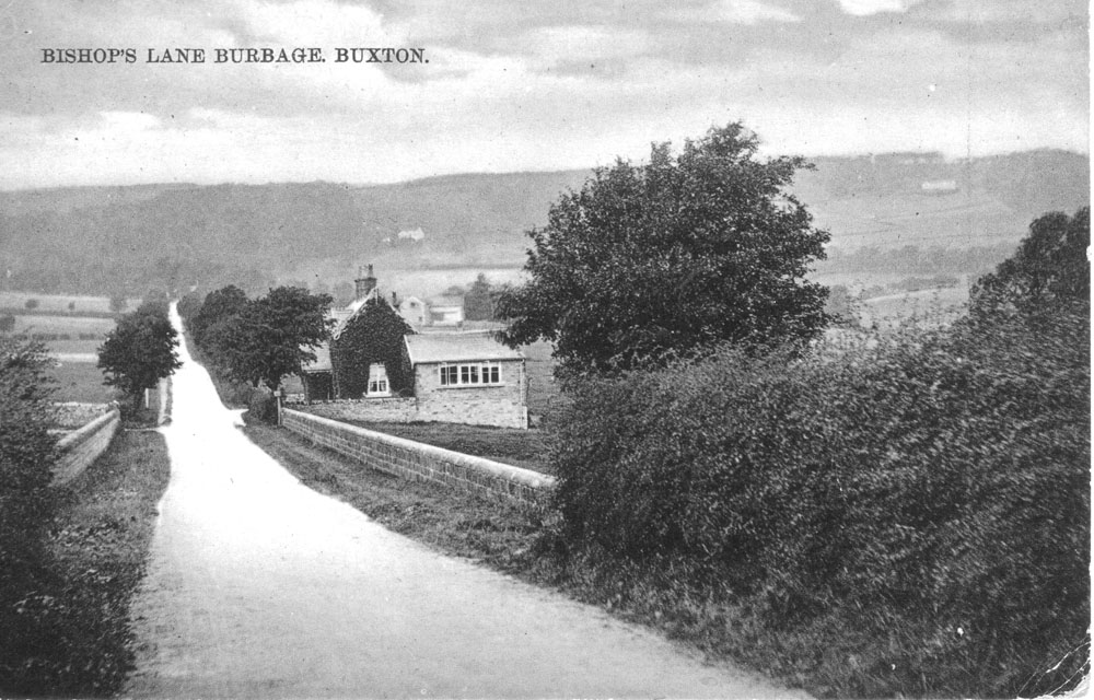
To the west of Burbage , the ground rises sharply to Burbage Edge, crossed by numerous ancient trails leading to the Goyt valley and on into Cheshire. Two coal seams in this area led to the development of the coal mines of Buxton which, though small by national standards, played an important part in providing fuel for prestige buildings such as the Crescent and Buxton Hall and to the development of the local lime burning industry; this locally produced lime played an essential role in the improvement of large areas for agricultural purposes.

Burbage Edge leads on to Axe Edge, to the south, and this high ground is the source of the Derbyshire Wye which flows through Burbage and Buxton on to Ashford and Bakewell to join the Derwent at Rowsley. The earliest land to be cultivated on a larger scale was on the slopes leading up to Burbage Edge where an area of land was enclosed from the rough moorland, probably in the 16th century.

As the population of Buxton grew in the 1950s and subsequently, residential developments led to a steady increase in the built up area of Burbage which now merges with Buxton itself. However, the area still retains its distinctive character.

WHY "BURBAGE"?

According to the book "Place Names in the Landscape" the place name "Burbage" is of Saxon origin with "Burh" referring to a fort and the "bage" referring either to a ridge or to a stream. Since Burbage is close to the high ridge known as Burbage Edge and has the river Wye running through it, either description fits.

Likewise, on the eastern side of the Peak District, on the high ground above Grindleford, we find Burbage Moor, Burbage Rocks and Burbage Brook which runs down Padley Gorge into Grindleford to join the Derwent.

A further link between these two Burbage locations is their position as entry points into the White Peak area. In 1759, two Turnpike roads were created linking to Buxton -from the Cheshire plain on the west and South Yorkshire on the east, each of them following long established packhorse routes. The Macclesfield to Buxton Turnpike crossed Burbage Ridge and descended into the Wye valley through Burbage while the Sheffield to Buxton Turnpike came across Ringinglow and Burbage Moor before descending to Hathersage.

In the early 900s, the Saxons were advancing against the Danes to extend the area under Saxon control. Derby was taken by the Saxons in 917 and Nottingham in 918. To improve their control over the Peak District, a burh was built at Bakewell in 920, as recorded in the Anglo -Saxon Chronicles. The location of this burh has not been confirmed by archaeological evidence but, based on place name evidence, Trevor Brighton in "Bakewell, the ancient capital of the Peak" suggests the area known as Burton , a short distance from the town of Bakewell which developed as a key Saxon location over the next few years. A burh was also constructed in Manchester in 919.

From the recorded pattern of Saxon burhs, it seems possible that Burbage was an intermediate smaller unrecorded burh on the key route from Derby to Manchester via Bakewell, with the eastern Burbage also on an important strategic link up the Derwent valley to South Yorkshire. Each of these Burbage locations has high ground from which a beacon fire warning of invading Danes could have been seen at Burton Moor on the high ground above Bakewell.

So, perhaps Burbage was a lonely isolated frontier outpost helping to keep marauding Danes away from Saxon England .... who knows?

Roads, Burbage Plantation, The Village Today, Burbage Band

Coal Mines

Early Farming days in Burbage

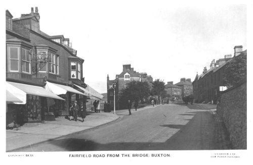
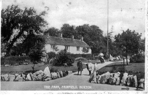
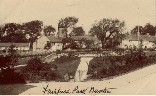
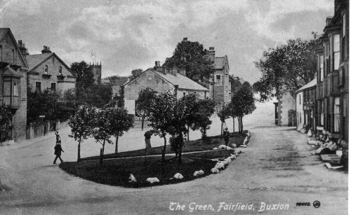
Fairfield

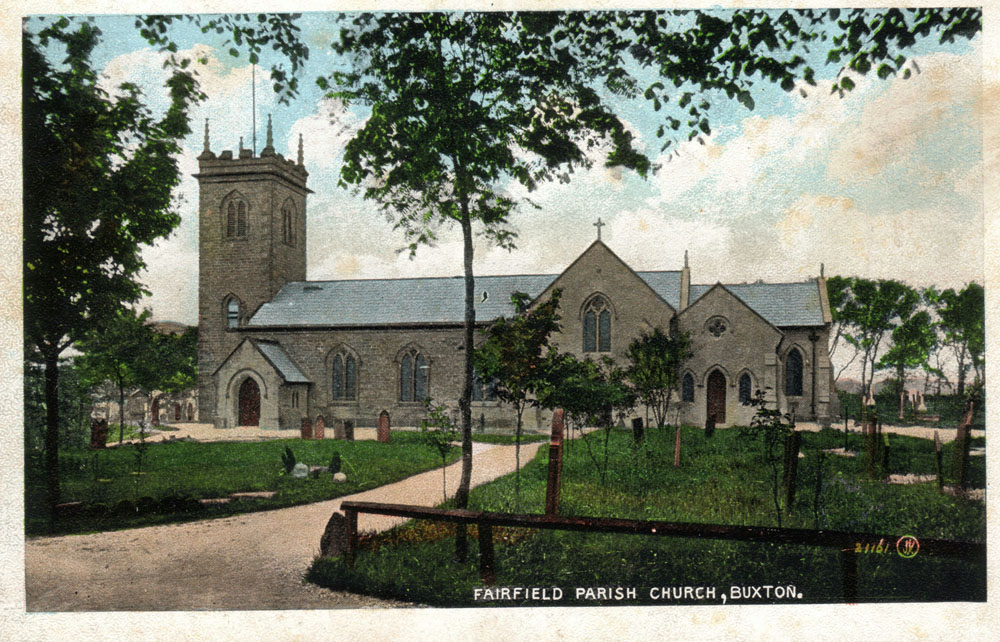
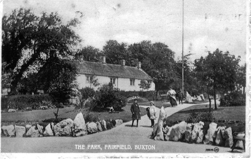
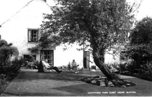
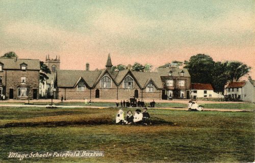
During the mediaeval period, Fairfield was a small single street village high up on the limestone plateau of the White Peak as also were Higher Buxton, Chelmorton, Taddington, Sheldon and various other small settlements on either side of the Wye Valley. In Norman times, Fairfield was in the Royal Forest of the Peak, the boundary of which lay along the Wye valley.

The Tithe Map of 1843 shows the "Township of Fairfield in the Parish of Hope" still as a single street village along Waterswallows Road together with the area around the church, separated by the road leading to Dove Holes but the whole township also covered an extensive rural area. This stretched westwards towards Gadley Lane and Nithen End, with the Wye as the boundary with Buxton township, northwards towards Batham Gate and eastwards to Woo Dale, again with the Wye as the southern boundary. So, before the creation of the borough of Buxton in the late 19th century, the area now occupied by Park Road, the Devonshire Dome, Corbar Woods and Corbar road were in the Fairfield Township.

The arrival of the railway to Buxton in 1863 (with a special halt for the race course on Fairfield Common) led to a growth of population in Buxton and a major growth in the local limestone quarrying industry, each of which contributed to a sustained residential growth in Fairfield.

Fairfield Road is one of the major road arteries of Buxton (now the A6). Established as a Turnpike Road to Sheffield in 1759 with the later addition of a branch towards Barmoor Clough in 1820, the steep climb from the river valley leads to congestion problems at busy times.

We would like to add more to our Fairfield section. Do you have images that you could contribute? Please get in touch.

  • Green Fairfield
  • Fairfield Church
  • Fairfield Common
  • Lost territory
  • Fairfield Band
  • Fairfield Residents Association
  • The A6 what we can do? (see
  • Ashwood Dale
  • Golf Course
  • How our places and spaces have changed

Community Directory

Would you like to see you business listing here?
Send your images and your story. Tell us how your place has changed?

Higher Buxton

Higher Buxton Is the Oldest District of the town

The town of Buxton has a central area with an important leisure, cultural and heritage content, which is reasonably well known to visitors to the town.

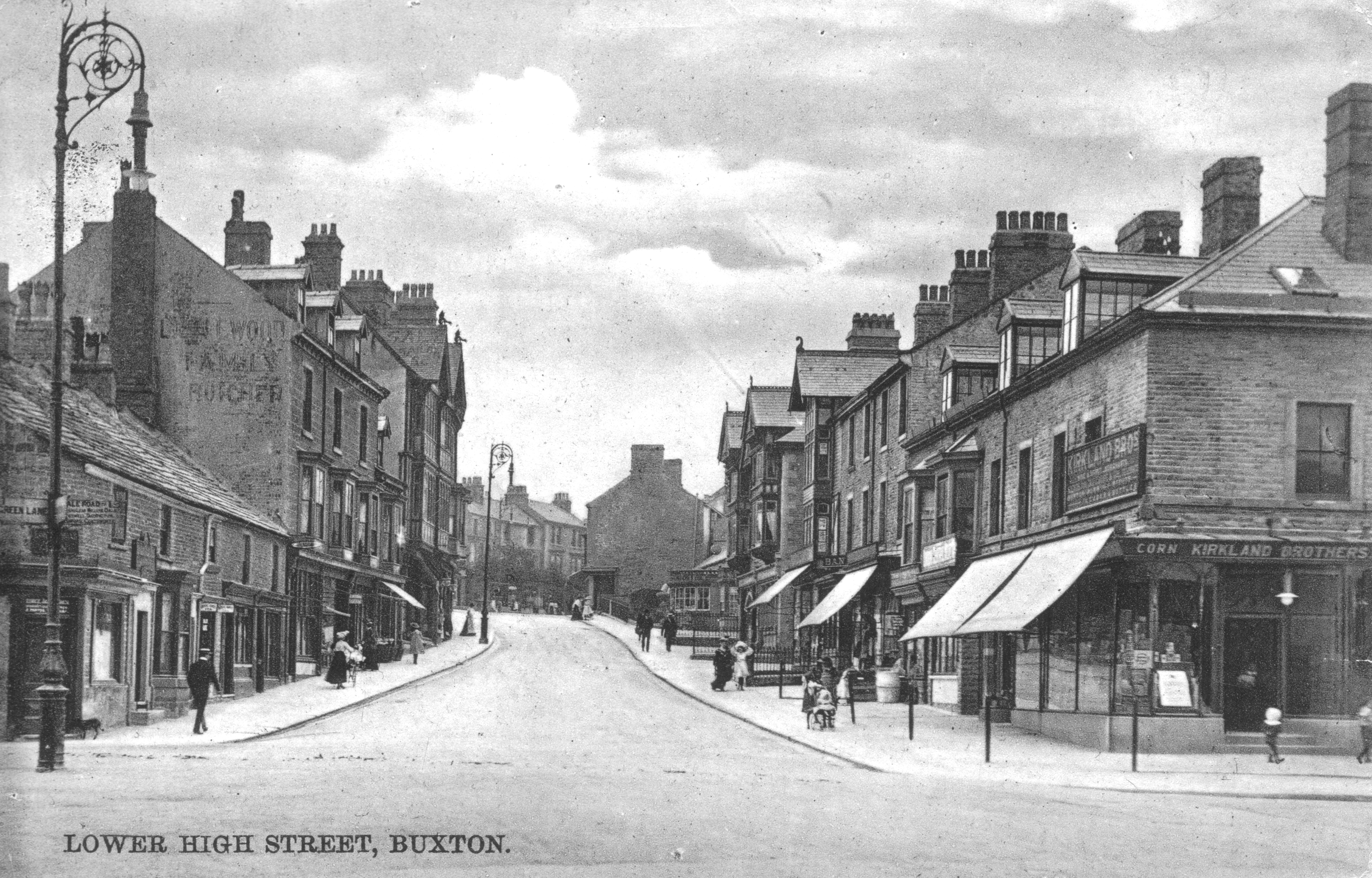
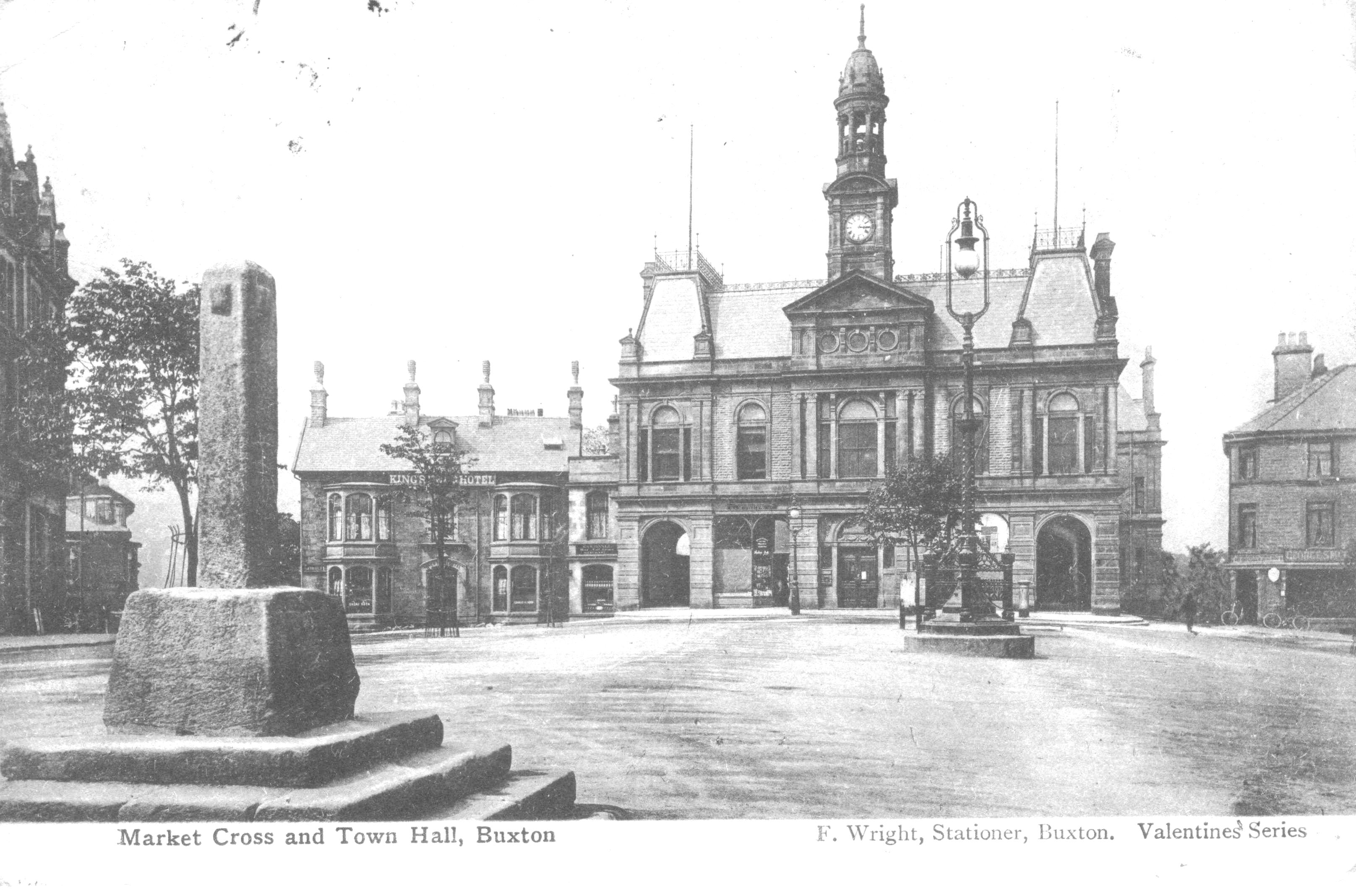
The oldest district of the town is Higher Buxton, stretching from the site of the Town Hall, along the Market Place to St Ann's Church at the top of Bath Road.

Less well known are the surrounding residential areas and the important communities that border the central area, Burbage, Fairfield and Harpur Hill, each with its own distinctive heritage and community life.

A map of 1631 shows Higher Buxton as a single street village spread along the area between the present Town Hall and St Anne's Church at the top of Bath Road, covering the Market Place and High Street. Two roads are shown , one leading down to Buxton Hall and the mineral water springs and the other to a building close to where the Grove Hotel now stands; these correspond to Hall Bank and Terrace Road.

The video below from 1901 gives an overview of the town and the visual contrast to the description of the 1631 map.

In the Higher Buxton area, the road layout is very similar today compared to the 1631 layout. The map also shows the water mill site on the Wye, where the weir in Ashwood Park is now located; this mill also served Fairfield village on the other side of the river. Although the street layout has not changed significantly since 1631, there has, of course been extensive rebuilding over the centuries.

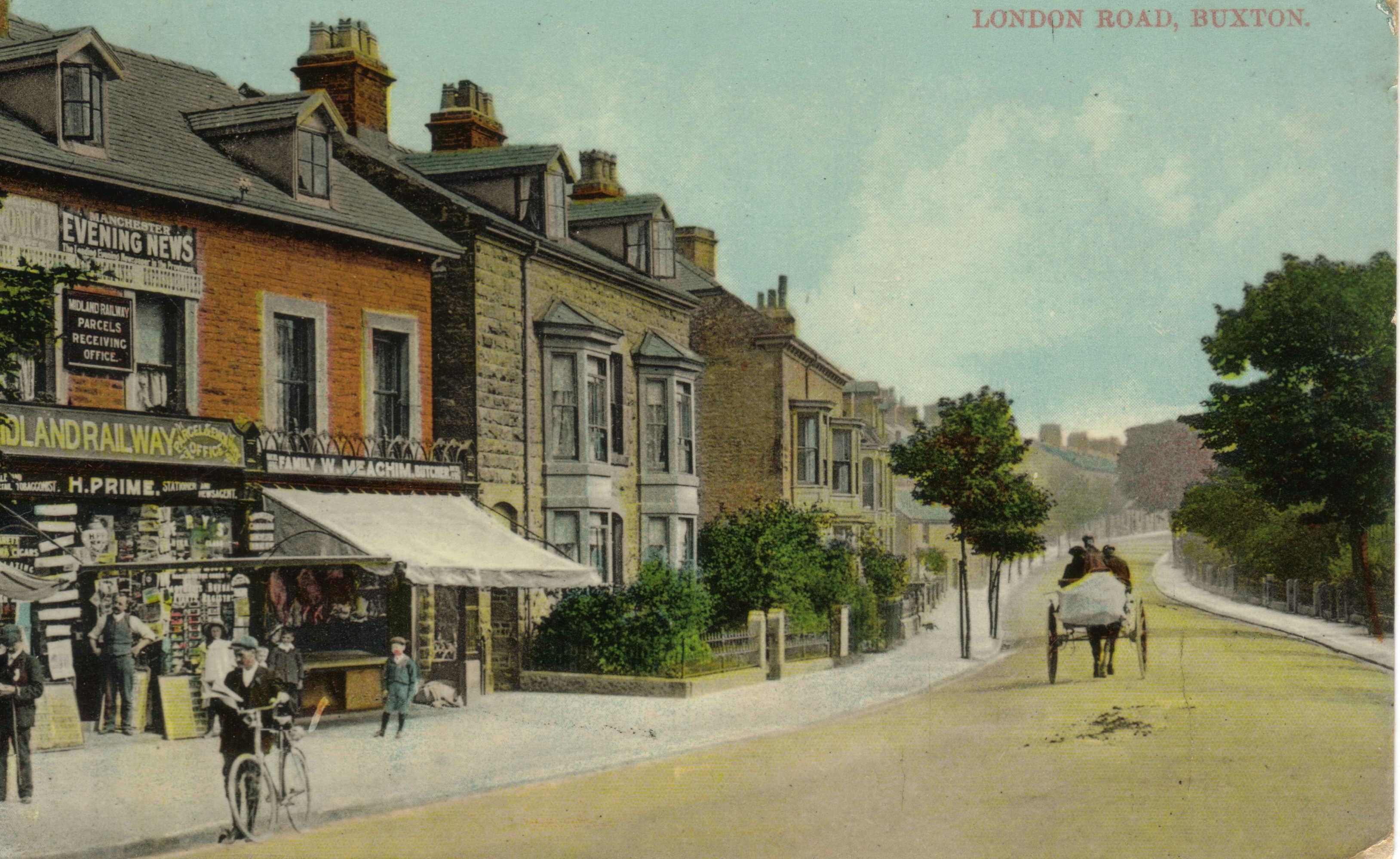
Following the arrival of the railway in 1863, buildings and streets spread out from the Market Place area , as the area of Hardwick Square was developed and in the early 20th century Dale Road was built linking London Road with Ashwood Dale.

Early Farming days in Burbage

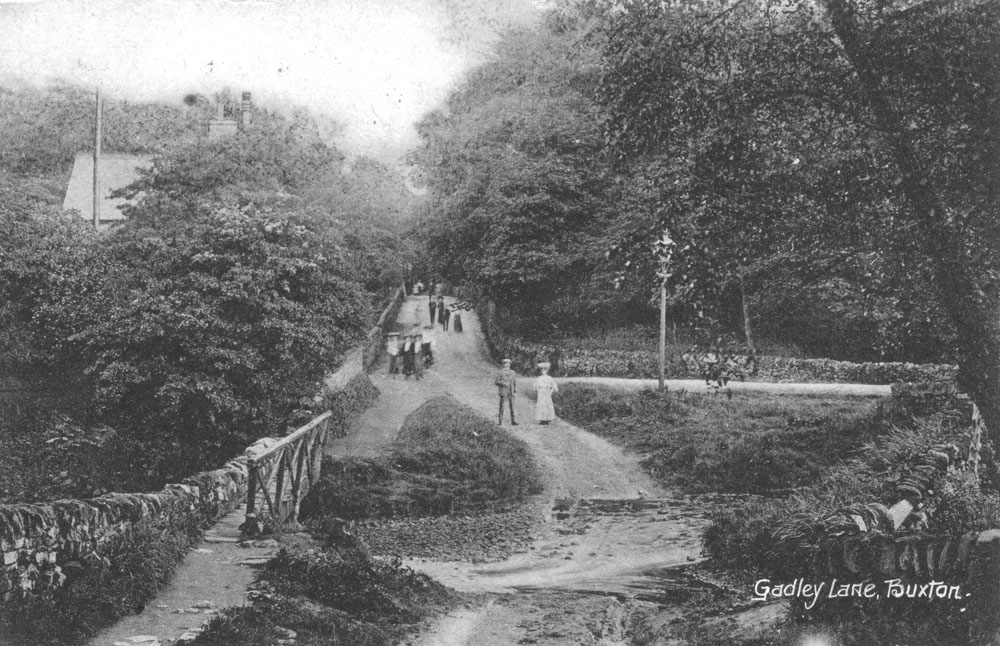
The key point about the history of Burbage is that Burbage was in the Manor of Hartington and not in the Manor of Buxton, so information is found under that heading. A 1614 map of the Manor of Hartington by Heyward shows Burbage as an isolated block of enclosed fields with scattered farmhouses, between Burbage Edge and the Manor boundary by Gadley Lane . The enclosed land is shown divided into 15 fields and the total area of enclosed land is 385 acres. The Nedeham (or Nedham) family are listed as the tenants for approximately half of this area and the other tenants listed had the surnames Tidderimgton, Lomas, Brocklehurst, Knolles, Ferne, Dakyne and Bennet.

Farm buildings were shown in positions corresponding to the present locations of Gutter, Beet and Watford Farms. The other key location on the map is Otterhole mill, described as "now decayed". The mill was rebuilt in 1684 at a cost of £46. 5s and Andrew Norton paid £10 yearly rental as the miller but there are no further references to it on later documents.

At Otterhole (adjacent to Otterhole Farm which is not shown on the 1614 map), a spring emerges from the limestone rock and the water flows into the Wye, a short distance away. The mill was located between the entry point of the spring water and Gadley Lane. Slight traces of the mill can be seen in the Wye - rows of stones (normally submerged) where the weir and side channel of the mill system had been before being displaced and a localised widening of the river channel.

The main field pattern has been modified over the centuries, particularly by the construction of the Cavendish Golf course on part of the land, but the main outlines can still be traced. This field system represents a planned enclosure of common land before 1614. One possible reason for the enclosure was the construction of Buxton Hall in the 1570s, by the Earl of Shrewsbury for the accommodation of Mary Queen of Scots. Her stay, along with her retinue and the Earl of Shrewsbury's attendants, would have required additional food supplies in this rather remote area, so cultivated land with a mill would have been useful for that food supply.

A further instance of the Earl's involvement in this area came in 1608, with a dispute that went to the Star Chamber in London. The Earl of Shrewsbury owned the tithes and members of the Dakin family went to collect the tithes owed by Brocklehurst. This resulted in a violent dispute with allegations of attacks by pitchforks and damage to walls.

Harpur Hill

A short drive from central Buxton along the road leading towards Ashbourne, immediately past the turn off for the Buxton Hospital, there is a right turn for Harpur Hill Road. A mile or so up this road, there is the junction of Harpur Hill Road, Burlow Road (on the left) and Grin Low Road (on the right). The Parks Inn is at this junction, more or less at the centre of the oldest part of Harpur Hill village.

The road to the right takes one past the village school on the right and some older cottages on the left before leading to a substantial dip in the road. Just before the main dip, a private road leads off to the left, marked by display signs for Harpur Hill Business Park and the Health and Safety Laboratory. This road leads to an area originally known as The Frith, which is the location of the strange happenings, to be described in this book. From 1916 to 1918, it housed The Frith Artillery Range; from 1926 to the present day, it housed the Experimental Station of the Safety in Mines Research Board which, after numerous organisational changes, led to the Health and Safety Laboratory; from 1938 to 1969, it housed RAF Maintenance Unit 28, an extensive bomb store. Together, they represent an unusual and often noisy combination of three government facilities, constructed in response to wartime threats (in two cases) and to the dangerous conditions in coal mining in the other.

Continuing along the Grin Low Road, past the appropriately named Brook Bottom Farm at the bottom of the dip and up the other side, the road passes along the southern edge of Grin Low, the prominent tree covered hill to the south of Buxton, with the tower of Solomon's Temple at its summit, visible from many parts of the town. Grin Low Road forms a junction with the Leek to Buxton road at Ladmanlow and here a right turn leads back to central Buxton.

A more energetic and more rewarding way to understand Harpur Hill and its relationship to the surrounding countryside is to walk from the Poole's Cavern car park, on Green Lane in Buxton, through Grin Low woods to Solomon's Temple. From the top of the tower, there is a panoramic view that has been well described in an article in the Buxton Civic Association Newsletter.

Buxton Civic Association Newsletter

For present purposes, the key aspects of the view are as follows:
Standing on top of the tower and looking to the south, the large modern structure is the main building of the Health and Safety Laboratory, opened in 2005. To the left, there is an array of smaller buildings of various types, forming the Harpur Hill Business Park. Further to the left are the remains of the former Harpur Hill quarry, with the old quarry faces carved into the hill that dominates the skyline at that point. The older part of Harpur Hill village and the Parks Inn lie at a lower level and further to the left there is a block of 1950s houses ,built to accommodate RAF staff based at Maintenance Unit 28. Beyond there, Burlow Road runs down to join the Buxton to Ashbourne road at Brierlow Bar about 2 milles south of the Harpur Hill Road turnoff referred to above.

Beyond the laboratory building there is an extensive stretch of open country on the limestone plateau of the White Peak. The jagged silhouette of Thirkelow Rocks make a striking feature in this direction. In the foreground, the narrow dip in Grin Low road at Brok Bottom can be seen to branch out into a widening set of small limestone dales marked by small isolated farmsteads named Dale End, Countess Cliff and Turncliff.

Further to the right, the skyline is dominated by the bulk of Axe Edge which, with its summit at 550 m , is the highest point in this locality. Axe Edge is a high point on a north/south ridge running down towards the Roaches and here the rock strata consist of gritstones and shales, characteristic of the Dark Peak. There are two relatively small coal seams in the land to the west of the Axe Edge summit, dipping down in a westerly direction. The Buxton to Leek road can be seen running along the lower slopes of Axe Edge and the important boundary between the rocks of the White Peak and those of the Dark Peak is a short distance down from the road. The smaller lower hill to the right of the Axe Edge summit is called The Terret.

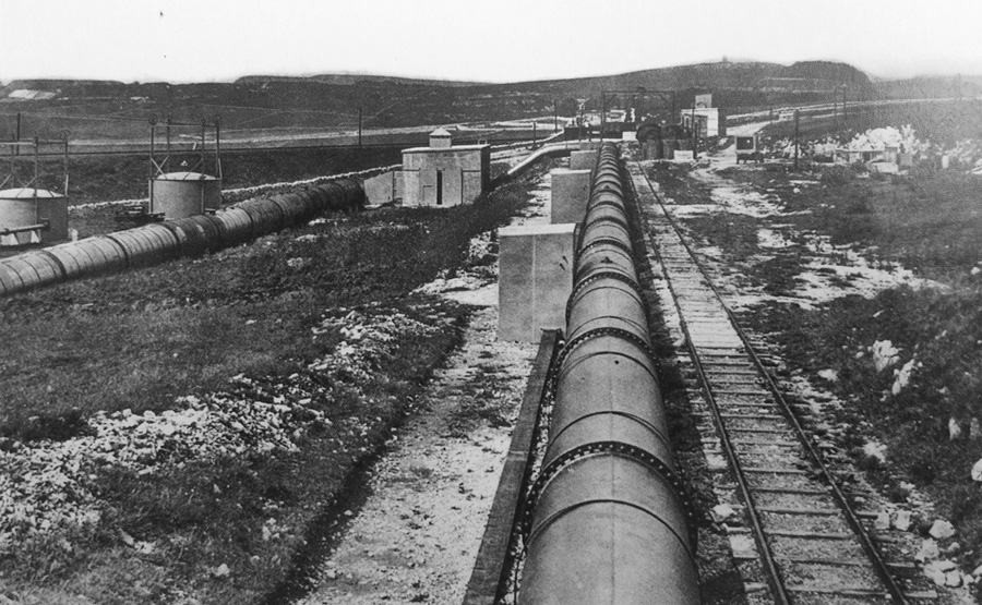
The ridge of Grin Low runs from Solomon's Temple westwards almost as far as The Terret and the Buxton to Leek road and the Cromford and High Peak Railway each squeezed through the gap between Grin Low and The Terret. Grin Low quarry was located at the western end of the ridge and its outline can be seen from the tower. At one time, a sea of coal would have been visible from the tower as the disused quarry was filled with a national reserve stock of coal in the 1950s, said to be a million tons in total and visible above the quarry rim. This coal was removed and the quarry was landscaped and converted to a caravan park in the 1970s. Prior to the development of the main Grin quarry, there were numerous small quarries and lime kilns used along Grin Low, the remains of which can still be seen.

This view from Solomon's Temple provides the landscape context for the events at Harpur Hill.

Harpur Hill - Contributions to Places & Spaces

RAF Maintenance Unit 28

Health & Safety Safety Laboratory

The Frith Artillery Range

Vision Buxton Summer Social

Vision Buxton Summer Social - Thursday 2nd July

On Thursday 2nd July, Vision Buxton is holding it's biggest ever Summer Social Event at the Devonshire Dome, Buxton. At only £10 a head - and being generously hosted and subsidised by Vision Buxton sponsors the University of Derby - the event promises to be a great night. With catering students showcasing their culinary talents, and capacity for up to 80 guests, there is plenty of space to invite partners and work colleagues. Members of Buxton Civic Association are very welcome to attend!

The event runs from 6.30pm to 9.30pm with a buffet and a cash bar.

To make sure you have a place, please send or hand deliver your £10 per person to Pricketts Solicitors,
Please label envelope Summer Social, FAO Administrator, Vision Buxton and mark clearly your name and e-mail address so you will receive confirmation of your place.
Cheques payable to Vision Buxton.

Hurry and book your place!! Closing date for reserving a place is Monday 22 June.


Full address is;

Vision Buxton
c/o Pricketts
12 Hardwick Street
Buxton
Derbyshire
SK17 6BN

Do contact Maggie Reynolds at administrator@visionbuxton.co.uk if you need any more information