Extreme Litter Picking
Clearing the Birds Nest at Lovers' Leap
On Sunday 24 April, BCA’s Clean Team returned to Lovers’ Leap for the second stage of its on-going project to clear the whole beauty spot of rubbish. This time it had its eyes on the stream bed running through the gorge and what it had nicknamed the ‘bird’s nest’.
On the western wall of the gorge, some 15m from its mouth, there is a cleft. This starts below a ledge at the top of the cliff and finishes on solid rock some 8m below, At this point you are still some 20m above the stream. The cleft itself is full of loose natural debris which has accumulated over time and turned it into a steep unstable slope ending in a precipice. However, above this slope is a perfectly safe rock platform not difficult to reach from Dukes Drive and providing beautiful views of the gorge for those who cherish natural beauty. Unfortunately the location also excites to fever pitch the perverse desires of compulsive rubbish tippers. They just can’t stay away from the place. Over time, they must have disposed of literally tons of rubbish by throwing it from this platform down the slope and over the precipice. However, by no means all of it ended up in the stream below.
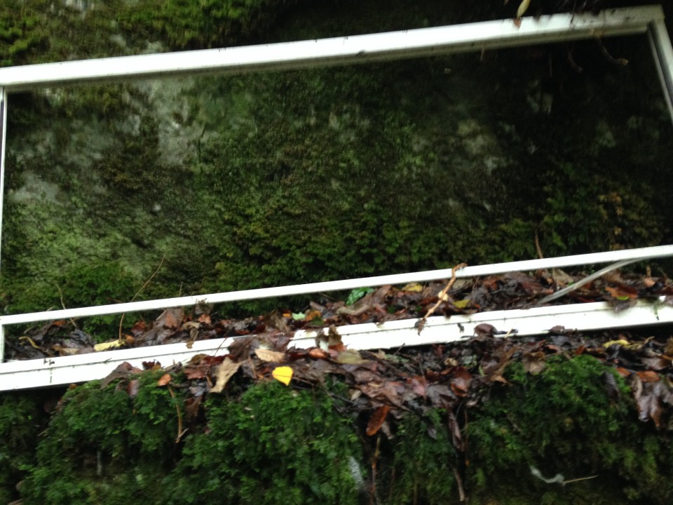
Growing out of the base of the cleft are two or three sturdy trees. Much of the refuse finished up in these. First, over time, a tarpaulin, plastic sheeting and bags got entangled in the trees forming a ‘safety net’ for much of the rubbish that followed. This included a large plastic water cistern, a double glazed window, broken bags of sand-cement mix, ropes, carpeting, underlay, bags of tin cans and - yes - yet another tent [see first episode in April 21 Advertiser] . From below the whole assemblage gave the appearance of a giant bird’s nest festooned with rubbish.
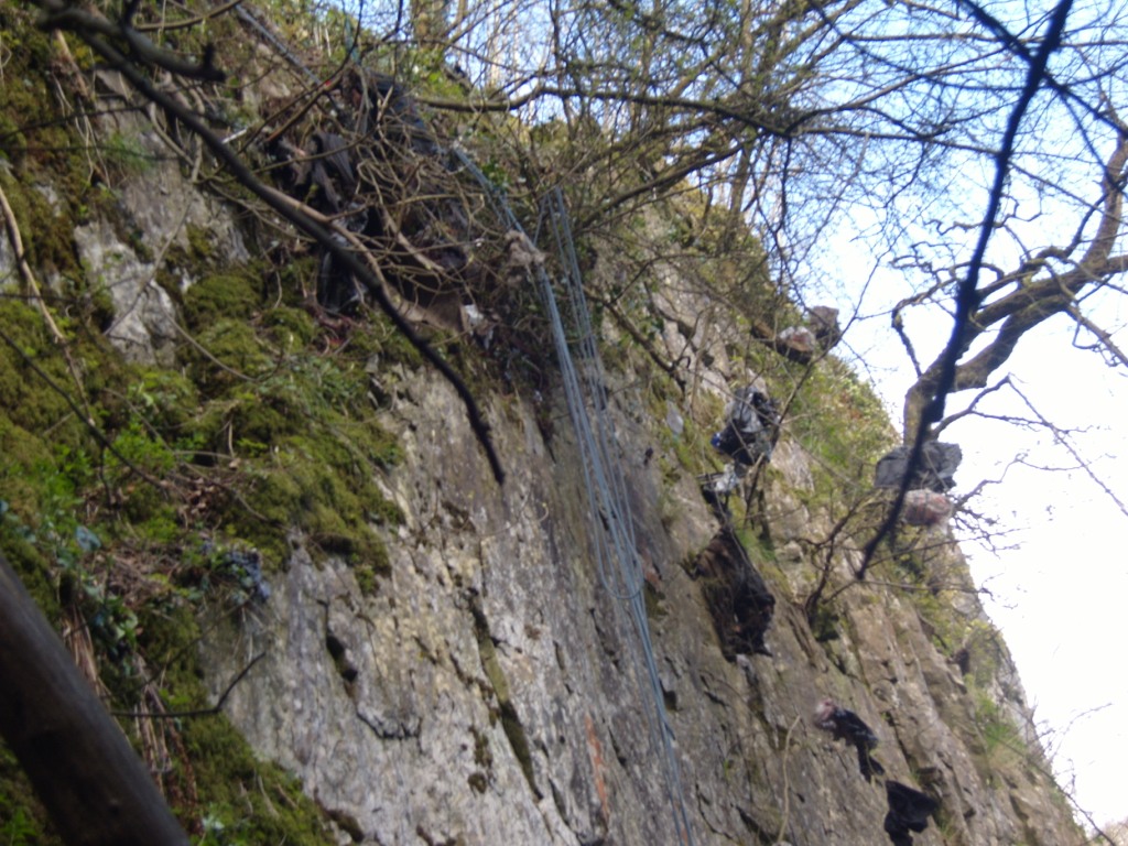
The Birds Nest
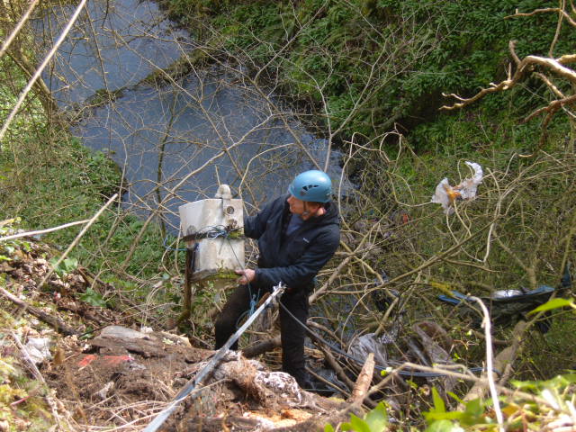
The only way to disentangle the rubbish from the trees was by hand. Someone had to abseil down to them and then tie off so as to be able to use both hands for the job. One Saturday morning in the Café Nero I mentioned the problem to my friend, Simon Hunter, a veteran rock climber and mountaineer. Whew! What a relief! He volunteered for the job straight away!
9 am, two weeks later, I arrived at Lovers Leap to find him already belayed to a stout tree growing above the platform. I watched as he backed down the loose slope and onto the cliff wall. I kept my mind fixed firmly on one of his previous exploits. Once he’d climbed the Piz Badile in the Swiss Alps by the Cassin route. This consists of 200m of relatively easy climbing followed by 800m of vertical or near vertical rock. He’d descended by the same route - 25 abseils, one after the other, on and on into the night. Today’s excursion was just a walk in the park for Simon. Nonetheless, I stayed by the belay. No stranger was going to come near it until Simon had returned to Terra Firma.
Simon frees the cistern from the clutches of the trees
We stacked the rubbish we’d gathered from the stream bed and cliff face at the gorge entrance. With their usual efficiency, High Peak Street Cleaning collected it the next day.
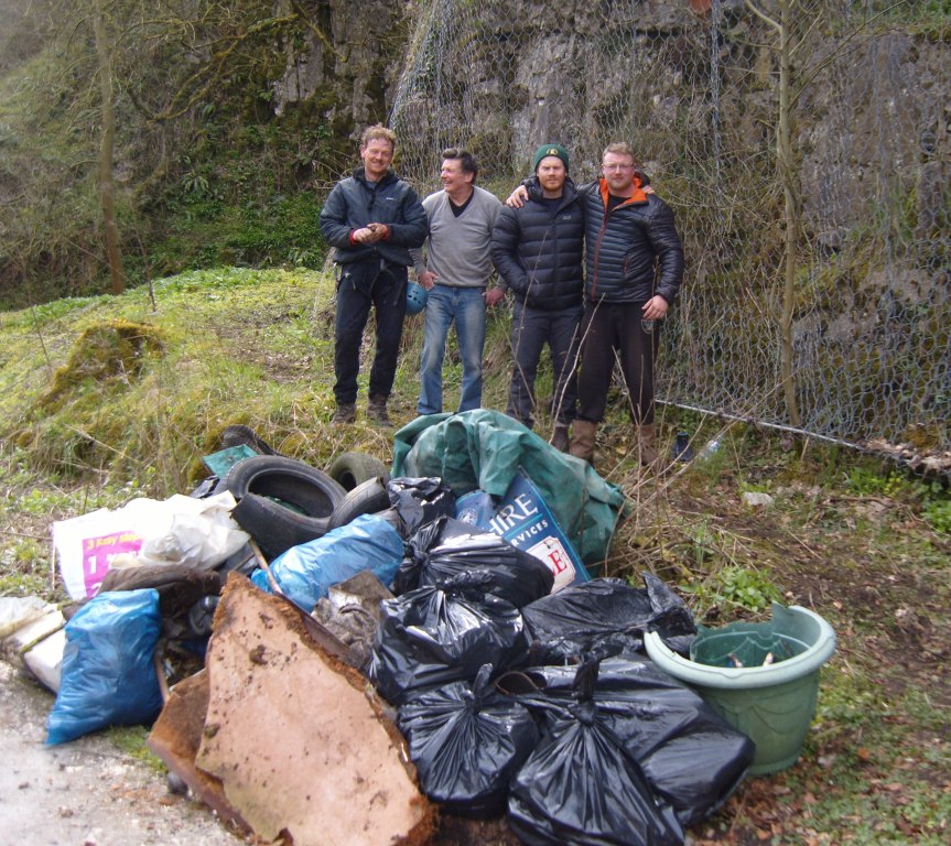
Not quite the whole team. Judith took the photo.
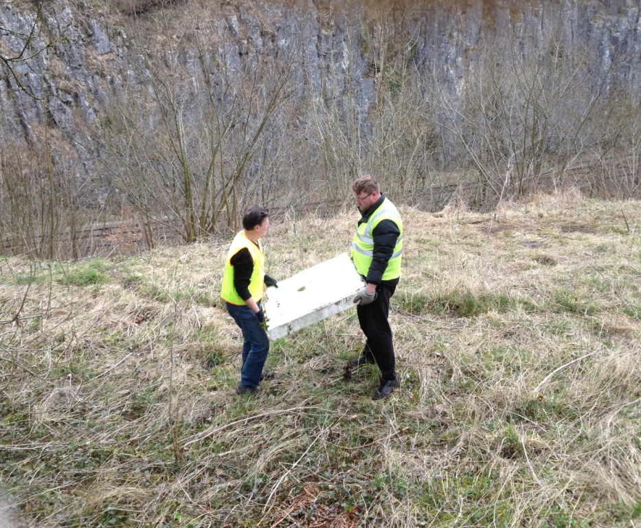
Man handling the shower base
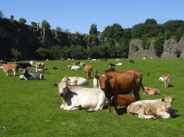
The name Lovers Leap conjures up romantic and perhaps tragic associations. Once a popular spot with Victorian couples, it is less visited now and it is true that the years have rolled by without anyone paying much attention to the condition of this secluded beauty spot located just outside Buxton.
Even so, members of Buxton Civic Association where stunned by the tide of rubbish they encountered when they surveyed the site earlier this year. Both the gorge itself and the slopes above the western cliff-face were strewn not only with bottles and cans but also bits of car bodywork, dumped kitchen appliances and building materials.
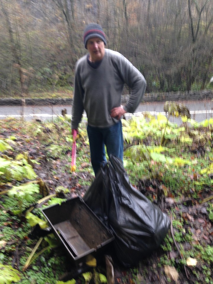
On 1 April, a small team of BCA members began the clean-up of the partially terraced slopes above the western cliffs. BCA Business Development Manager, Simon Fussell asked team leader, Roger Floyd, on site, what the team had found there. He replied that, clearly, for a long while, pedestrians on Dukes Drive and people in passing vehicles had been throwing bottles, cans, fast-food containers and other litter over the boundary wall onto the site. But that was far from the whole story.
“Parking here is awkward and access to the site if you are carrying large or heavy items is difficult”, he continued. “Buxton has an easy-to-reach, convenient-to-use, recycling centre where anyone can dispose of reasonable amounts of any kind of waste. And yet, inexplicably, some people seem to have actually chosen to dump items on this beauty spot rather than at the recycling centre. “For example”, he added, pointing to a curious rectangular object near our feet, “this 60 kg concrete shower base”.
Earlier in the day, two of the team had found three abandoned tents on the site. One was full of old clothes. The other two were fully equipped with cooking gear and bedding. Everything was in an advanced state of decay but clearly, at some time in the not to distant past, more than one person had been living there and for an extended period.
Our team were certain that was an ‘extended period’ because amongst the other detritus were 16 two-litre bottles all filled with a yellow fluid. Alas, hopes that it was a collection of rare vintage French wines were soon dashed when one of the bottles was opened. One of our campers had been collecting his own urine. Why? We shall never know. But he certainly didn’t amass his stockpile overnight.
In the end the bottles were left in the tent where they were found. The tents were then bundled up and left on Dukes Drive with the 25 sacks of litter, the shower base and other debris that the team had gathered from the site. To its great credit, the Borough’s Street Care and Cleaning Service sent a truck immediately to pick it all up, even though it was now late on Friday afternoon.
We expect that another three clean-ups will be necessary to clear the whole site.
Anyone for a glass of Chardonnay?
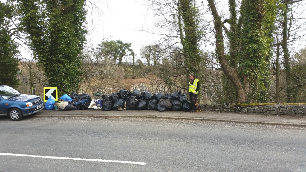
The fruits of a mornings litter picking at Lover's Leap
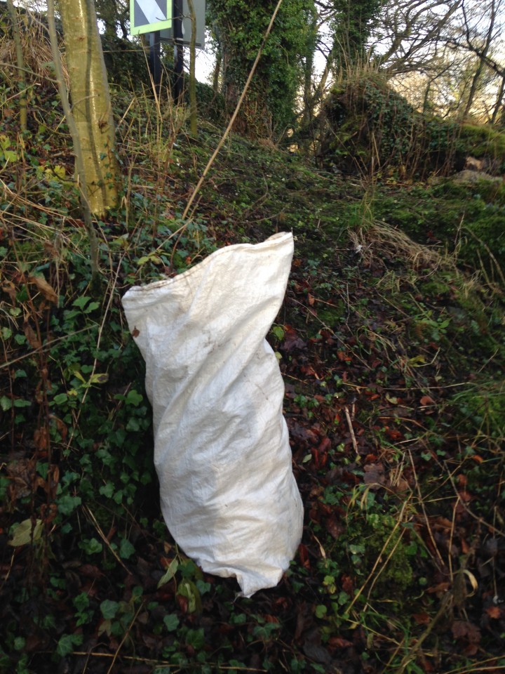
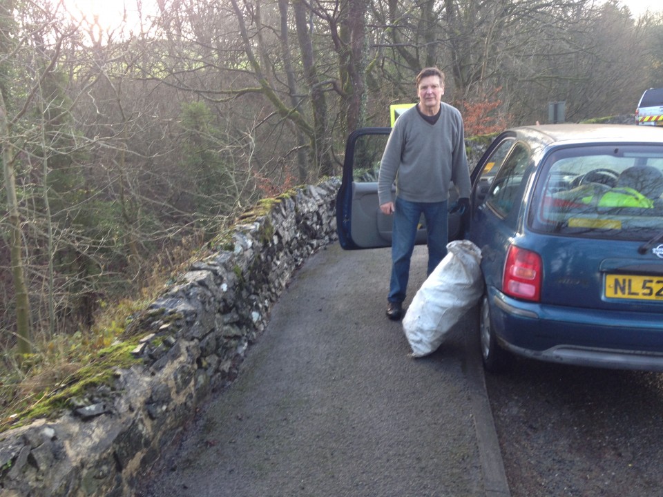
One of the issues that the Places and Spaces project has identified as of particular concern is the volume of rubbish that accumulates in and around some of our most famous beauty spots. Lovers Leap was mentioned at the last committee meeting, and so on a mild and sunny Monday morning, Roger Floyd and Simon Fussell set off to investigate and to see if it was practical and safe to organise some future litter picking activities at this famous landmark.
As can be seen from the photographs there is plenty of litter. In the space of an hour Roger and Simon picked up four sacks from the top of the gorge and from the lay by and path by the river.
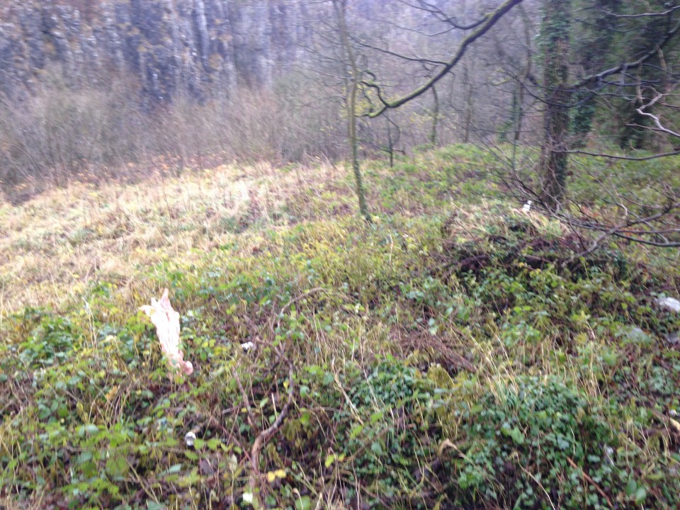

There is still lots of rubbish left at the sites. To tackle the problem properly will require a risk assessment and to ensure that anyone helping out is properly equipped. The A6 is busy and very dangerous and there are significant drops from the top of the gorge down to the stream.
We will also be contacting HPBC to request that they remove some of the larger objects.
We plan to hold a litter picking day at Lovers Leap at some point in the New Year, so if you are interested in helping out contact us at;
communications@buxtoncivicassociation.org.uk

the Opera House as seen from the Slopes
We have uploaded the presentations developed from the three themes identified at the meeting on 14th July 2015 and added two additional reports on the A515 gateway and the Macclesfield, Leek gateway.
If anyone is interested in being involved in this project, our next meeting is on 30th November 2015 at 6.00pm at Poole's Cavern Visitor Centre.
The Places and Spaces project is progressing. Further to the members meeting held in May, we are publishing (see link below) a complete list of the sites that were selected. We have also attached the list of selections sorted by themes.
The list is not final, and will be added to as and when further places and spaces are notified as being of relevance to the project.
A further meeting was held on 19th July and it was agreed that three of those themes would be further developed.
The three themes are;
1. Gateways to the town.
2. Vulnerable and at risk sites
3. Heritage trails
Three groups have been set up to progress these elements of the project. If anyone is interested in being involved please get in touch by email to our email address on the contact page on this website.
List of selections made at Places and Spaces Meeting 14th May 2015
The Health and Safety Laboratory at Harpur Hill is the present day successor to the following series of developments:
1924: The Experimental Station of the Safety in Mines Research Board
1948: The Safety in Mines Research Establishment, Ministry of Fuel and Power (later Ministry of Power)
1975: The Research and Laboratory Division, Health and Safety Executive
1995: The Health and Safety Laboratory (still part of HSE)
From 1924 onwards, the laboratory was part of a larger unit, with the main laboratory in Sheffield but, in 2005, a new large laboratory building was opened at the Harpur Hill site to accommodate all of the work at the Sheffield laboratory and the existing work on the site. This is the building referred to in the Introduction.
Kellingley, the last deep coal mine in Great Britain, closed in December 2015, bringing to an end many centuries of deep coal mining in this country (some open cast coal extraction continues). Any form of mining for minerals has associated safety problems but it has long been recognised that coal mining has additional safety problems because of the possibility of the emission of flammable gas from the coal seams as they are worked. This flammable gas, mainly methane and traditionally referred to as "firedamp" is absorbed within the coal seam and released as the seam is fractured; the quantity of gas released varies from seam to seam and, for a given seam, usually gets larger as the seam is followed to lower depths.
In the late 1930s, as the threat of war again developed over Europe, the Army, Navy and Royal Air Force were each looking for additional sites for the storage of weapons, ammunition and bombs. The preferred criteria for sites for ammunition and bombs were in disused mines (to give protection against aerial attack) and north of a line from the Bristol Channel to the Humber to increase the distance from German air fields. The three branches of the U K armed services were in competition with each other in this search and the RAF was slower off the mark than its competitors. It became apparent that there was a distinct shortage of suitable disused mine sites and a further approach was required. For this reason, the Frith site at Harpur Hill was again selected as a key location in the nation's defence system, as a site for a new design of major bomb store.
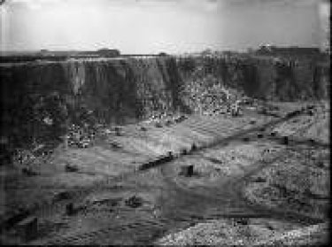
The design concept for the Harpur Hill store was a series of reinforced concrete galleries that would be covered by 60 feet of overburden, to give a similar level of protection against a bombing raid as would be provided by subterranean tunnels. As with the WW1 artillery range, the proximity of the site to Harpur Hill quarry, with its rail connection and other services, was favourable to the choice of site and an additional feature was the large quantity of quarry waste immediately available for covering the galleries on their completion. Furthermore, the close proximity of the large quarry meant that the construction work close by could easily be mistaken for quarry related activities in aerial reconnaissance.
The site was selected in 1938 and construction work began shorttly afterwards, with the RAF taking over in December 1939. The site was known formally as RAF Maintenance Unit 28 and it continued in operation until December 1960, with important effects for the town.
The design of the site was regarded as a success and a second site, to a similar design, was built in the large slate quarry at Llanberis in North Wales. However, during the adding of the overburden at the Llanberis site, large cracks were noticed in the concrete walls of the galleries and construction work ceased. Checks were then made at the Harpur Hill site and similar cracks were observed. The bombs were removed temporarily, in case of collapse, and a large part of the overburden was removed before the bombs were replaced in the repaired galleries.
Soon after the First World War broke out in August 1914, it became obvious that the British Expeditionary Force in France was ill prepared for the type of conflict that had developed. With both sides digging into trenches from the Channel coast to the Swiss border, the requirements were for types and quantities of artillery and ammunition that simply were not available to the BEF.
The War Office systems for weapons procurement were bureaucratic and out of date. Artillery production was limited to Royal Ordnance Factories and a few specialised firms, such as Vickers, and the production of shell cases and facilities for shell filling were similarly limited.
As the supply situation worsened during early 1915, David Lloyd George, the Chancellor of the Exchequer in Asquith's Government, pressed for radical changes in the supply lines which led to the creation of the Ministry of Munitions in May 1915, with Lloyd George as the Minister in charge. Even then the Whitehall battles continued, with the War Office resisting the changes proposed by Lloyd George. At one time, before the new Ministry had acquired the financial authority to purchase equipment, Lloyd George ordered a batch of mortars that were desperately needed, against the security of a financial guarantee by an Indian Maharajah, because the War Office system was so slow! However, by December 1915, all responsibility for procurement and development of military equipment had been passed to the Ministry of Munitions.
One of the key requirements for the BEF in France was for improved designs and improved numbers of Trench Mortars. The existing ROF design had a rifled barrel which required skilled craftsmen and specialised equipment for its manufacture; also these mortars had a low rate of firing and were not very accurate. An alternative design, developed by Wilfrid Stokes and rejected several times by the War Office, used cast tubes with no internal machining required with a simpler and quicker firing system, and it was more accurate. Against the opposition of the War Office, Trench Mortars based on the Stokes design became the weapon of choice. They did not need to be made in Royal Ordnance Factories because of their simpler design, as their manufacture could be contracted out to a wide range of engineering firms, and the supply line problems began to rapidly reduce. For example, in the second quarter of 1915, 121 trench mortars of all types were made but in the same quarter of 1916, 1976 were made (of which 1425 were Stokes mortars)
One problem that arose from the contracting out of manufacture was the need for proof testing of mortars before use. Accidents from faulty manufacture could prove fatal at the point of use. Existing ROF proof ranges, at Woolwich Arsenal and Shoeburyness (on the Essex coast) were insufficient and an additional proof test range was required. The search began for a new range.
It was against this background that the Frith Artillery Range was established, as described in Volume XI of "The Official History of the Ministry of Munitions":
"An important result of the manufacture of mortars by the trade was the organisation of a system of proof. So long as trench howitzers had been produced only by the Ordnance Factory and Vickers the only tests applied were departmental inspections in the one case and a firing test on the firm's own range in the other. in the autumn of 1915 it was decided to take Vickers' certificate of proof but to prove other trade-made mortars at Woolwich. In the spring of 1916, when mortars and ammunition were coming forward in unprecedented quantities, a distinct proof range was established for trench mortars at Buxton."
The same publication also has information on an additional role undertaken at the Frith Artillery Range from 1917:
"The breaking down of obsolete stores and the rectification of those rejected became a matter of importance during 1917 by reason of the general shortage of material. It was laid down ... that all rectification which involved explosive risks .... should generally be restricted to national factories. For this reason plant for rectifying trench mortars was installed at the Buxton store in July, 1917"
Information relating to this range can be found in a file at the National Archives at Kew (dealing with Ministry of Munitions papers, and the setting up the site) and in a file in the Chatsworth Archives (dealing with estate matters, the tenant farmers, restoration of the site etc). So far, no detailed information has been located on the types and numbers of weapons tested but it seems likely that a high proportion, if not all, of the Trench Mortars listed above were proof tested at The Frith range, making a major contribution to the efforts of the Army in France and elsewhere. As one example, the 3 inch Stokes mortar became the standard Trench Mortar in the winter of 1915 and in the second half of 1916, production of these mortars was between 100 and 200 per week.
"FRITH RANGE, BUXTON
The importance and rapid development of trench warfare initiated a conference at which D.G.M.D., D.T.W.S. and D.G.I.M. were represented, and the necessity of the immediate provision of a separate range for proving Trench Mortars and other trench warfare munitions was shown. The duty of finding and establishing a suitable range was charged to this department.
The S. of E. and the D.I.G.G. have approved the site, now known as the Frith Range, Buxton, which possesses many special advantages, and the negotiation for the land is being carried through by the Land Agent of the Northern Command under instructions of the Comptroller of Lands, War Office.
Plans have been prepared for laying out the site and for the erection of the buildings and works necessary to cover the requirements of the S. of E. and D.I.G.G., whose approval they have received.
With a view to acceleration and economy, Messrs. Pauling and Co. Ltd, Victoria Street, S. W. have been engaged, provisionally, as Construction Engineers on a commission basis of 2.5% on cost, plus extra allowances.. This firm is being employed on similar work under agreement by the Explosives Branch of the Ministry, who report the utmost satisfaction. Every effort is being made to advance this work sufficiently to allow a Military Camp to become established and commence firing in 14 days' time.
Enclosed are prints showing the site and plans of the buildings agreed upon, and a draft agreement, revised by the legal department, with Messrs. Pauling and Co. Ltd.
Certain movable equipment will be supplied by S. of E., and the necessary expenditure for works and plant, for which financial sanction is asked, has been estimated at £17,000. The works include Fencing; Railway connection, sidings and trollies; Levelling and Roadways; Mess Room, Barracks; Sheds and stables; Examination rooms, stores, magazines and danger buildings; Firing point works; Lighting, heating and water supply; Equipment and fittings, telephones."
The various sets of initials in this account stand for:
D.G.M.D., Director General of Munitions Design D.T.W.S., Director General Trench Warfare Supplies
D.G.I.M., Director General of Inspection of Munitions D.I.G.G., ?
S. of E. Superintendent of Experiments (this was a post based at Shoeburyness, see below)
"Dear Sir
I should be extremely grateful if you could help me in the following matter.
The War Office has asked me to identify any site which may exist in the Command area for the use of the Trench Warfare Department.
That Department is anxious to get land in the Midlands, North Midlands or South Yorkshire. The area required would be rectangular, two miles long by one mile wide. About one acre of this land would be required for buildings.
As much of the area as possible should be visible from the firing point from which it should preferably slope downwards. The soil should be dry.
There will be a good deal of heavy transport so it is desirable the site should be within four or five miles of a station and the nearer the better.
The matter appears to be of much urgency. It seems to me that possibly there are many waste tracts or tracts of land of little agricultural value in the North Midlands which would meet the requirements set out above. Moorland, heath etc on light soil might suit.
Land of this description is not always known of by the War Department and there is therefore a possible chance of you being able to help me in this matter, by suggesting any possible site so that we may more expeditiously meet the requirements of the Trench Warfare Department.
I should therefore be grateful if you could treat this as urgent and send me any particulars of any suitable site accompanying the same if possible by a plan.
yours sincerely C W Brighton,
Captain Northern Command Land Agent"
"I am directed to inform you that certain land in the vicinity of the Frith has been definitely selected by the Ministry of Munitions for Trench Mortar Range.
Official notice signed by competent military authority has been served on each tenant and a separate plan has been served with that notice explaining in detail portions of their farm in respect of which total and exclusive possession is required."
The National Archives file covers the issues relating to the legal basis for setting up the range, the commissioning of a building contractor and the connections of the range to the railway and to electricity and water supplies. In each case, the urgency of the project is emphasised.
On the 6th May 1916, Lt Colonel Haynes, Superintendent of Experiments, Shoeburyness, circulated a rough draft of Bye Laws relating to the closure of the site. By the end of May, the draft had been through various stages of consultation and was ready to be sent to the printers with a target date of 1st July for the opening of the range. A short delay led to the Bye Laws coming into force on 1st August 2016 and notices were sent to the local newspapers and displayed as posters to announce that fact. The Bye Laws, made under the Defence of the Realm Act, 1914, prohibited any civilian from entering defined areas of land, with powers of arrest of any caught doing so, and some outer areas where sheep could be grazed at agreed times with the written permission of the Range Commander. A map was published showing these areas. The road from the Buxton to Leek road on Axe Edge to Glutton Bridge was closed at Dale Head on the western side and Harley Cross Gate on the eastern side. The range boundaries were described, in general terms, as:
" The Frith Artillery Range: The land between Harpurhill Works and Anthony Hill on the North, and the river Dove on the south, and between Thirkelow and Booth on the west, and the disused tramway and the road from Harley Cross Gate to the cross roads at Glutton Dale on the east."
At the same time, discussions were taking place on the appointment of a contractor for the construction of the site. A letter of 5th June 1916 recommends the firm of C Pauling and Co of Victoria Street London as the contractor and this was confirmed. The firm had good experience in this type of work and a good reputation for prompt action so, because of the urgency of the situation, the appointment was made very quickly
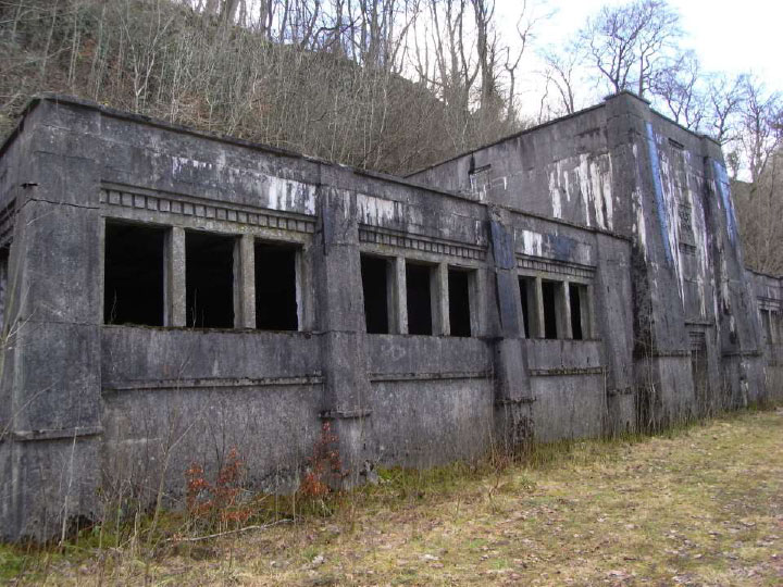
The contract was on a cost plus basis, with a profit margin of 2.5% for the contractor and Pauling's invoice sets out every item of expenditure down to door knobs and curtains. The following summaries were given for the residential buildings:
Officers Quarters 2419 Square Feet
Mess Room 1539 Square Feet
Barracks 2222 Square Feet
Latrines 399 Square Feet
In addition, stores, a firing shed, examination rooms and a magazine were constructed.
1162 yards of railway track were laid down, with one main track connected to the LNWR line and one siding. On site, about 300 yards of road were constructed for the quarters and about 500 yards for the operational area.
Originally, there was no road access to the site so that an access road 1342 yards long was constructed past the Ferney Bottom farm buildings. The present day road follows the same line, although with modern improvements.
There is no plan of the site layout on the file but there is a plan for the connection of the railway siding to the LNWR line which shows that this siding used the long straight disused section of the CHPR line, running approximately north/south. This same line is shown on the 6 inch to the mile Ordnance survey map, published 1923, together with two buildings fairly close to the LNWR route. These buildings probably correspond to the buildings constructed by Pauling for the range.
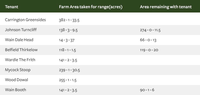
All of the land taken by the range was owned by the Duke of Devonshire and let out to tenant farmers who, obviously, experienced unsettling conditions.
The land taken for the range was recorded as:
During the construction and fencing of the range, some problems arose with the tenants for the areas remaining with farmers. In one case, Drewry, the Duke's agent wrote that "fences are impossible as these are mountain sheep that can not be kept on restricted areas of land". In another case, there were protests because walls had been broken down and not repaired, leading to the loss of stock. In July 1916, Captain Brighton arranged an on site meeting with Drewry and the tenants and no further problems are recorded.
By the end of October 1916, construction work was almost finished and compensation arrangements were discussed. It was agreed that, from the 10th August 1916 (which seems to have been the actual takeover date), the tenants' rents would be reduced in proportion to the amount of land taken by the range and the Duke of Devonshire would be compensated by the Defence of the Realm Losses Commission.
Throughout the war, there was a steady improvement in the performance of trench mortars with regard to reliability, power and range. The Official History noted that the different types of mortars in use in 1915 had ranges from 340 to 900 yards. By 1917, some mortars had ranges up to 2000 yards. This increase in range required an extension of the range boundary at Greensides Farm(which was about 2000 yards from the firing point) and the vacating of the farm buildings. An unexpected consequence of this change was the interruption to the water supply to some local dairy farms. A reservoir had been constructed on Greensides Farm land which was supplied from a local spring, with the water pumped up by two ram pumps. Of the seven farms supplied from this reservoir, five were outside the range boundary. Although the reservoir and the pumps were protected by earth mounding, the shock waves from the exploding shells travelled through the ground and tripped out the pumps. Since the farm was now unoccupied and there was no civilian access to the site, the pumps remained out of action for long periods of time and the water supply to the farms failed. A letter from the Devonshire Estate Office in Buxton noted that this was interfering with important milk supplies to Manchester, Buxton and the Glutton Cheese Factory. After some delay, the problem was solved by the purchase of an oil fired pump to raise the spring water to the reservoir.
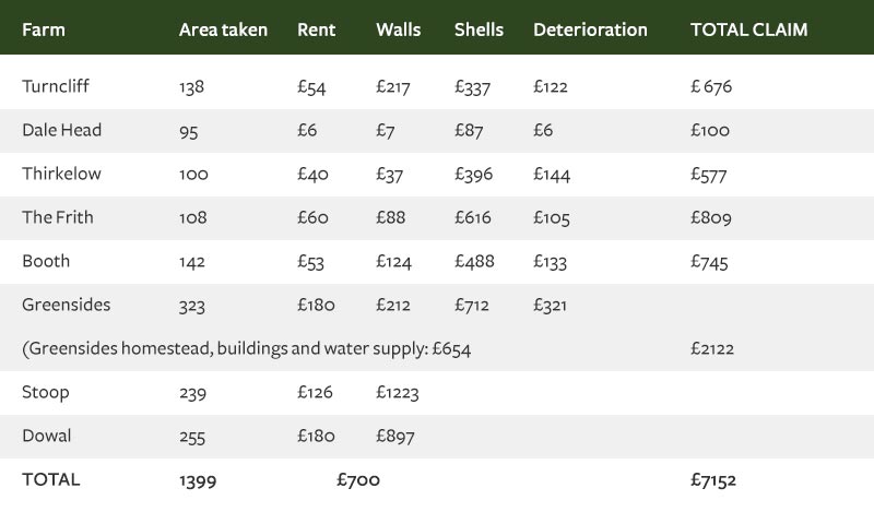
The range closed shortly after the end of the war in November 1918 and then attention turned to the restoration of the site and compensation for the losses incurred. One witness described the difficulty of walking across parts of the site and its resemblance to a battlefield. There were shell holes to be filled, shell fragments to be removed and repairs to be made to walls and buildings The terms of the takeover of the land meant that there was a two year period to claim for damage of that nature although there was an unlimited liability for the Army to remove any unexploded shells that might be discovered in later years. The damage claims were recorded under different headings as set out below:
Summary of areas taken by M of M, rent for that land and damage claim
So far, no detailed information on the number and type of trench mortars tested at the Frith has been located. One account states "as far as I am aware, all of the trench mortars manufactured and sent abroad were proof tested at the Frith".
The Official History records that in 1917, for example, about 6000 trench mortars were produced. Whatever the numbers the Frith Artillery Range clearly played a vital part in the equipping of the British forces on the western front.
Although the site is little known locally, some evidence of its activities remained. In the late 1970s, building work on the HSL site began to turn up significant quantities of shell fragments remained. These were cleared to allow the buildings to be completed but a follow up operation lasting several months removed over 30,000 shell fragments. As recently as February 2016, work on the preparation of the Peak Cycle Link Trail near Stake Side, turned up further fragments.
As our places and spaces evolve we can continue to improve on our surroundings. For a positive change it is important to capture and record our impact on the area.
How do we keep our places & Spaces in Check?
A6 - Buxton Approach Roads (Awaiting Latest Update)
Neglected Areas, Vulnerable to development (Awaiting Latest Update)