Would you like to see you business listing here?
Send your images and your story. Tell us how your place has changed?
News and Events
We love to hear about your experience and see your photographs through the seasons. Don't forget to follow us on Facebook and share our pages. We know we've done a great job when you've had a fantastic day out!
Higher Buxton
Higher Buxton Is the Oldest District of the town
The town of Buxton has a central area with an important leisure, cultural and heritage content, which is reasonably well known to visitors to the town.
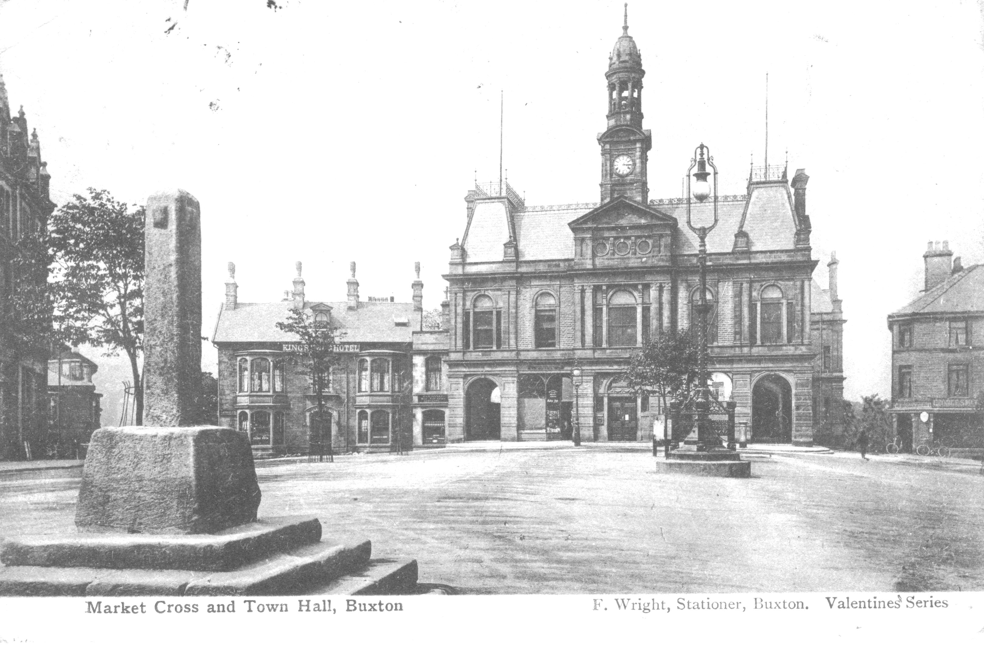
The oldest district of the town is Higher Buxton, stretching from the site of the Town Hall, along the Market Place to St Ann's Church at the top of Bath Road.
Less well known are the surrounding residential areas and the important communities that border the central area, Burbage, Fairfield and Harpur Hill, each with its own distinctive heritage and community life.
A map of 1631 shows Higher Buxton as a single street village spread along the area between the present Town Hall and St Anne's Church at the top of Bath Road, covering the Market Place and High Street. Two roads are shown , one leading down to Buxton Hall and the mineral water springs and the other to a building close to where the Grove Hotel now stands; these correspond to Hall Bank and Terrace Road.
The video below from 1901 gives an overview of the town and the visual contrast to the description of the 1631 map.
In the Higher Buxton area, the road layout is very similar today compared to the 1631 layout. The map also shows the water mill site on the Wye, where the weir in Ashwood Park is now located; this mill also served Fairfield village on the other side of the river. Although the street layout has not changed significantly since 1631, there has, of course been extensive rebuilding over the centuries.
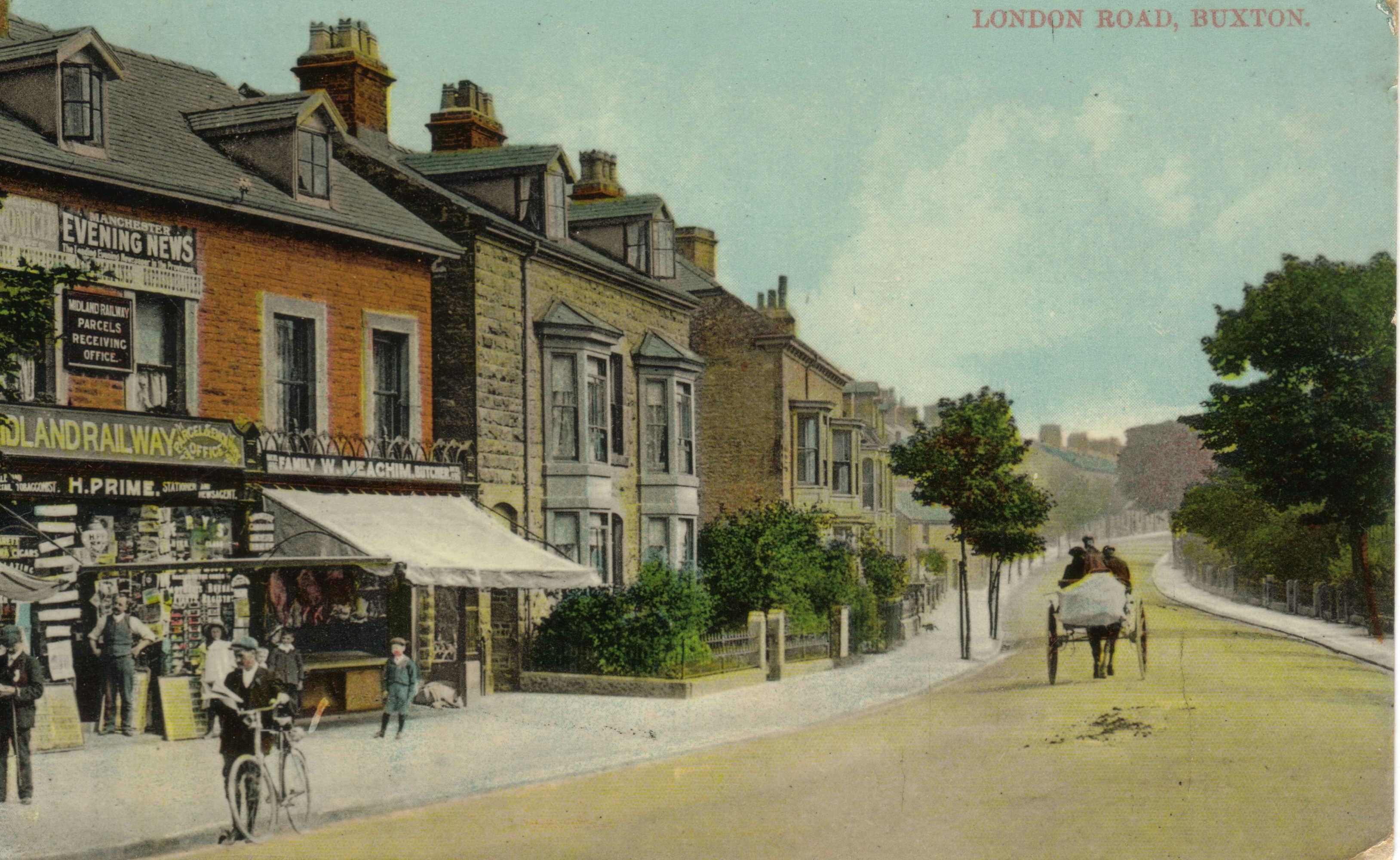
Following the arrival of the railway in 1863, buildings and streets spread out from the Market Place area , as the area of Hardwick Square was developed and in the early 20th century Dale Road was built linking London Road with Ashwood Dale.
Early Farming days in Burbage
The key point about the history of Burbage is that Burbage was in the Manor of Hartington and not in the Manor of Buxton, so information is found under that heading. A 1614 map of the Manor of Hartington by Heyward shows Burbage as an isolated block of enclosed fields with scattered farmhouses, between Burbage Edge and the Manor boundary by Gadley Lane . The enclosed land is shown divided into 15 fields and the total area of enclosed land is 385 acres. The Nedeham (or Nedham) family are listed as the tenants for approximately half of this area and the other tenants listed had the surnames Tidderimgton, Lomas, Brocklehurst, Knolles, Ferne, Dakyne and Bennet.
Farm buildings were shown in positions corresponding to the present locations of Gutter, Beet and Watford Farms. The other key location on the map is Otterhole mill, described as "now decayed". The mill was rebuilt in 1684 at a cost of £46. 5s and Andrew Norton paid £10 yearly rental as the miller but there are no further references to it on later documents.
At Otterhole (adjacent to Otterhole Farm which is not shown on the 1614 map), a spring emerges from the limestone rock and the water flows into the Wye, a short distance away. The mill was located between the entry point of the spring water and Gadley Lane. Slight traces of the mill can be seen in the Wye - rows of stones (normally submerged) where the weir and side channel of the mill system had been before being displaced and a localised widening of the river channel.
The main field pattern has been modified over the centuries, particularly by the construction of the Cavendish Golf course on part of the land, but the main outlines can still be traced. This field system represents a planned enclosure of common land before 1614. One possible reason for the enclosure was the construction of Buxton Hall in the 1570s, by the Earl of Shrewsbury for the accommodation of Mary Queen of Scots. Her stay, along with her retinue and the Earl of Shrewsbury's attendants, would have required additional food supplies in this rather remote area, so cultivated land with a mill would have been useful for that food supply.
A further instance of the Earl's involvement in this area came in 1608, with a dispute that went to the Star Chamber in London. The Earl of Shrewsbury owned the tithes and members of the Dakin family went to collect the tithes owed by Brocklehurst. This resulted in a violent dispute with allegations of attacks by pitchforks and damage to walls.
Harpur Hill
A short drive from central Buxton along the road leading towards Ashbourne, immediately past the turn off for the Buxton Hospital, there is a right turn for Harpur Hill Road. A mile or so up this road, there is the junction of Harpur Hill Road, Burlow Road (on the left) and Grin Low Road (on the right). The Parks Inn is at this junction, more or less at the centre of the oldest part of Harpur Hill village.
The road to the right takes one past the village school on the right and some older cottages on the left before leading to a substantial dip in the road. Just before the main dip, a private road leads off to the left, marked by display signs for Harpur Hill Business Park and the Health and Safety Laboratory. This road leads to an area originally known as The Frith, which is the location of the strange happenings, to be described in this book. From 1916 to 1918, it housed The Frith Artillery Range; from 1926 to the present day, it housed the Experimental Station of the Safety in Mines Research Board which, after numerous organisational changes, led to the Health and Safety Laboratory; from 1938 to 1969, it housed RAF Maintenance Unit 28, an extensive bomb store. Together, they represent an unusual and often noisy combination of three government facilities, constructed in response to wartime threats (in two cases) and to the dangerous conditions in coal mining in the other.
Continuing along the Grin Low Road, past the appropriately named Brook Bottom Farm at the bottom of the dip and up the other side, the road passes along the southern edge of Grin Low, the prominent tree covered hill to the south of Buxton, with the tower of Solomon's Temple at its summit, visible from many parts of the town. Grin Low Road forms a junction with the Leek to Buxton road at Ladmanlow and here a right turn leads back to central Buxton.
A more energetic and more rewarding way to understand Harpur Hill and its relationship to the surrounding countryside is to walk from the Poole's Cavern car park, on Green Lane in Buxton, through Grin Low woods to Solomon's Temple. From the top of the tower, there is a panoramic view that has been well described in an article in the Buxton Civic Association Newsletter.
Buxton Civic Association Newsletter
For present purposes, the key aspects of the view are as follows:
Standing on top of the tower and looking to the south, the large modern structure is the main building of the Health and Safety Laboratory, opened in 2005. To the left, there is an array of smaller buildings of various types, forming the Harpur Hill Business Park. Further to the left are the remains of the former Harpur Hill quarry, with the old quarry faces carved into the hill that dominates the skyline at that point. The older part of Harpur Hill village and the Parks Inn lie at a lower level and further to the left there is a block of 1950s houses ,built to accommodate RAF staff based at Maintenance Unit 28. Beyond there, Burlow Road runs down to join the Buxton to Ashbourne road at Brierlow Bar about 2 milles south of the Harpur Hill Road turnoff referred to above.
Beyond the laboratory building there is an extensive stretch of open country on the limestone plateau of the White Peak. The jagged silhouette of Thirkelow Rocks make a striking feature in this direction. In the foreground, the narrow dip in Grin Low road at Brok Bottom can be seen to branch out into a widening set of small limestone dales marked by small isolated farmsteads named Dale End, Countess Cliff and Turncliff.
Further to the right, the skyline is dominated by the bulk of Axe Edge which, with its summit at 550 m , is the highest point in this locality. Axe Edge is a high point on a north/south ridge running down towards the Roaches and here the rock strata consist of gritstones and shales, characteristic of the Dark Peak. There are two relatively small coal seams in the land to the west of the Axe Edge summit, dipping down in a westerly direction. The Buxton to Leek road can be seen running along the lower slopes of Axe Edge and the important boundary between the rocks of the White Peak and those of the Dark Peak is a short distance down from the road. The smaller lower hill to the right of the Axe Edge summit is called The Terret.
The ridge of Grin Low runs from Solomon's Temple westwards almost as far as The Terret and the Buxton to Leek road and the Cromford and High Peak Railway each squeezed through the gap between Grin Low and The Terret. Grin Low quarry was located at the western end of the ridge and its outline can be seen from the tower. At one time, a sea of coal would have been visible from the tower as the disused quarry was filled with a national reserve stock of coal in the 1950s, said to be a million tons in total and visible above the quarry rim. This coal was removed and the quarry was landscaped and converted to a caravan park in the 1970s. Prior to the development of the main Grin quarry, there were numerous small quarries and lime kilns used along Grin Low, the remains of which can still be seen.
This view from Solomon's Temple provides the landscape context for the events at Harpur Hill.
Harpur Hill - Contributions to Places & Spaces
June Newsletter

Vision Buxton Summer Social

Vision Buxton Summer Social - Thursday 2nd July
On Thursday 2nd July, Vision Buxton is holding it's biggest ever Summer Social Event at the Devonshire Dome, Buxton. At only £10 a head - and being generously hosted and subsidised by Vision Buxton sponsors the University of Derby - the event promises to be a great night. With catering students showcasing their culinary talents, and capacity for up to 80 guests, there is plenty of space to invite partners and work colleagues. Members of Buxton Civic Association are very welcome to attend!
The event runs from 6.30pm to 9.30pm with a buffet and a cash bar.
To make sure you have a place, please send or hand deliver your £10 per person to Pricketts Solicitors,
Please label envelope Summer Social, FAO Administrator, Vision Buxton and mark clearly your name and e-mail address so you will receive confirmation of your place.
Cheques payable to Vision Buxton.
Hurry and book your place!! Closing date for reserving a place is Monday 22 June.
Full address is;
Vision Buxton
c/o Pricketts
12 Hardwick Street
Buxton
Derbyshire
SK17 6BN
Do contact Maggie Reynolds at administrator@visionbuxton.co.uk if you need any more information
Butterfly Transect update
Hello Everyone,
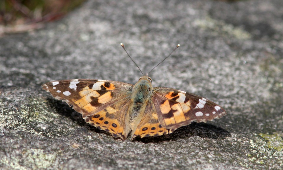
Just a quick Update to advise that the recent plume of hot air from the Iberian Peninsular has resulted in a reasonable number of both Painted Lady and Clouded Yellow butterflies reaching the UK and here in Derbyshire we have had 7 sightings of the Painted Lady during the last couple of days! First of all 4 Painted Lady butterflies were seen yesterday (4th June 2015) at Northwood, Darley Dale (Christine Gregory – photo attached) and today Pat and I saw 3 Painted Lady butterflies on the Blackwell Trail near South Normanton, all of which looked fairly worn having been caught up in the strong southerly air flow which spread across the country during the last couple of days.
Hopefully this species will still be around this weekend and I will be pleased to receive details of further sightings within the County.
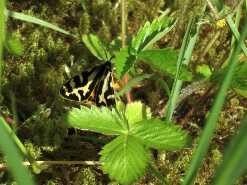
A couple of additional day flying moths have been recorded during the last week with the Chimney Sweeper moth appearing at some Lowland sites and the Wood Tiger being noted at a few sites in the Peak District (photos attached).
Regards,
Ken Orpe
Buxton’s Street Trees
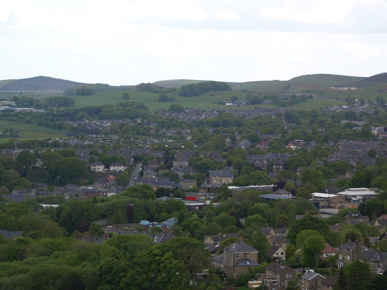
View of Buxton from Light wood Resevoir
As part of our campaign to raise awareness about Buxtons Street trees, we held a competition for those that attended the Charity Bazaar on Saturday to guess the number of Street Trees in Buxton.
People's guesses ranged from over 16,000 to 150. The actual number of trees as at 1st June 2015 was 945. No one guessed correctly so the winner will be the person who got closest to the actual total. We will be notifying them separately.
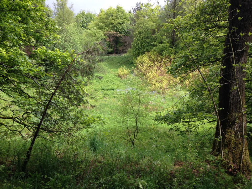
Gadley Wood in early June
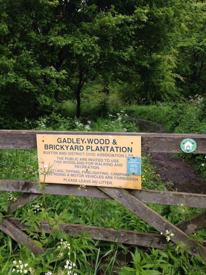
One of the ways into the wood.
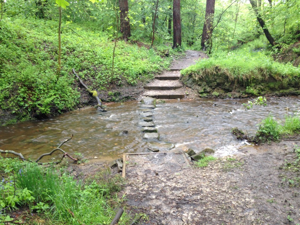
The stepping stones were almost underwater
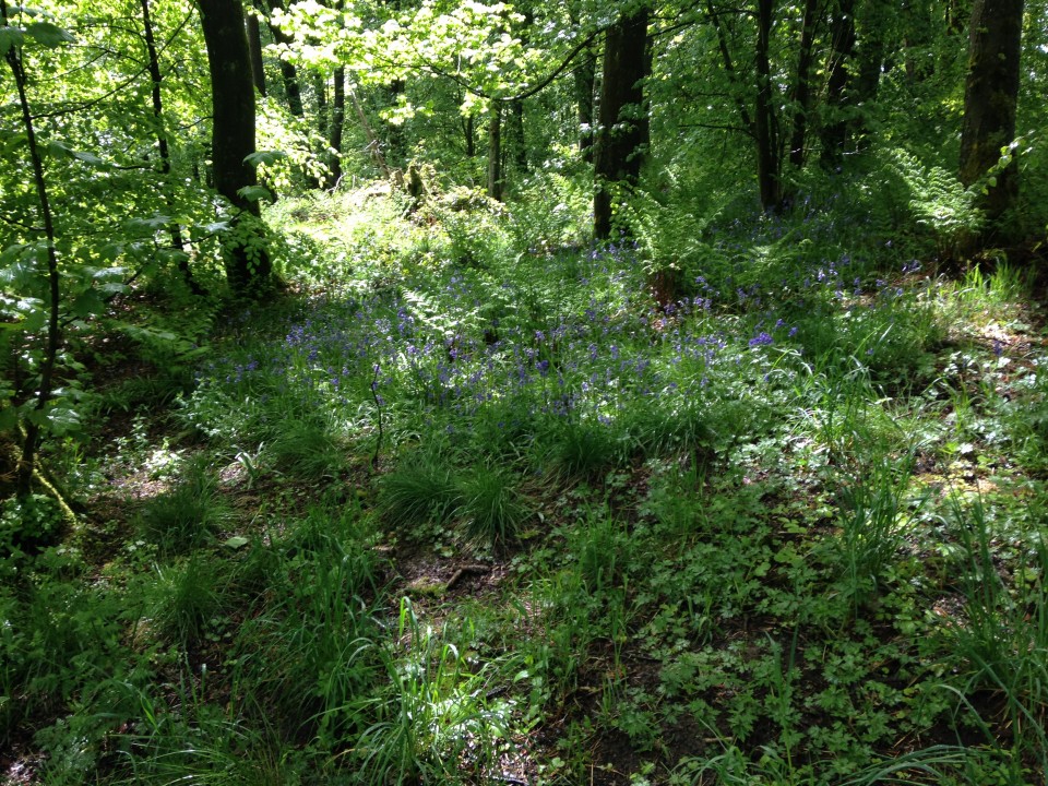
Bluebells were still looking good
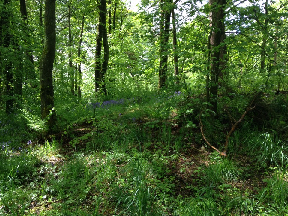
A great open space for birds and invertebrates
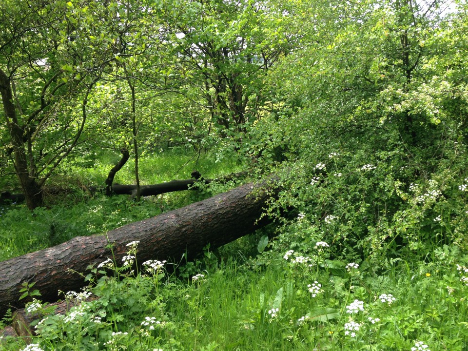
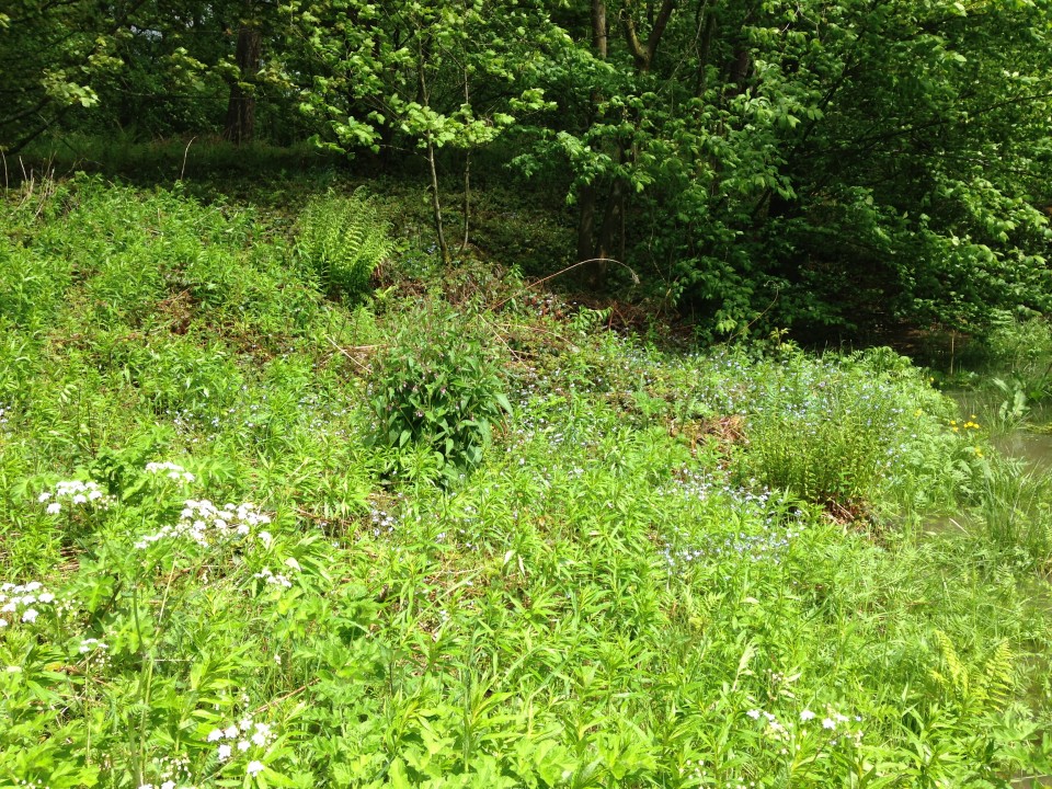
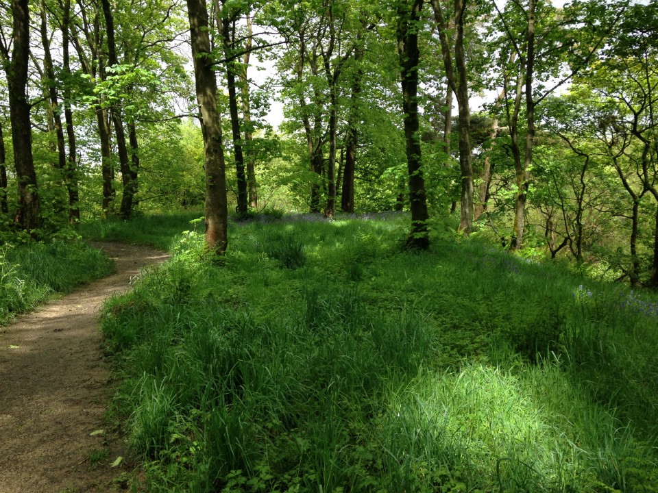
A sequence of photographs taken on an iphone on 2nd June in Gadley wood. It had just stopped raining and the birds especially the great tits were very noisy.
Derbyshire Butterfly Transect Report No 19
Including the First Large Skipper sighting of 2015
Hi Everyone,
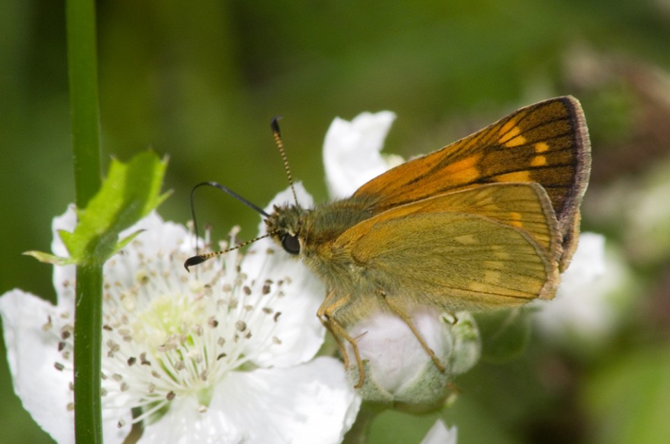
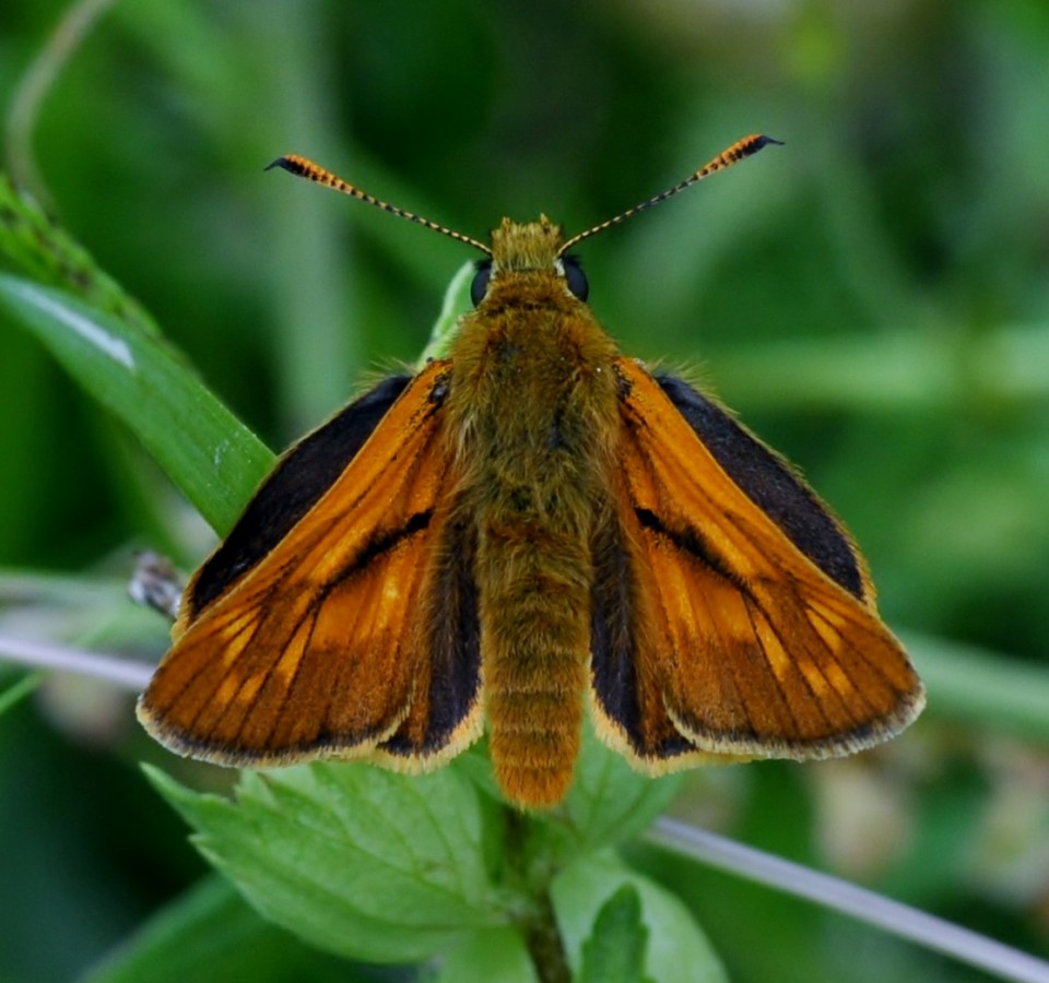
In meteorological terms, today is the last day of Spring and May 2015 will go down as a cold and wet month generally (similar to 2013) which explains why the transect results have been particularly poor for what is normally a very productive month for butterflies. Surprisingly, the total number of species seen in the month has been 20 with the addition of the Large Skipper during the last 10 days, the first sighting being on the 21st of May 2015 at Williamthorpe NR (Willy Lane).only 4 days later than the earliest date for this butterfly in 2014. This is the first of the summer skippers to emerge and it is somewhat larger than the other 2 golden skippers – namely the Small Skipper and the Essex Skipper. It also has a chequered pattern on both the upperside and underside of the wings which the other 2 skippers do not have. Also the tips of the antennae, although black underneath, have a hooked end. They are also usually seen perched on foliage, rather than grasses, with bramble being a favourite plant. The other 2 skippers are not expected to be on the wing until mid June (for the Small) and early July (for the Essex) so any golden skipper that is seen in the next couple of weeks is likely to be the Large Skipper.
It is pleasing to note that the Dingy Skipper has managed to survive at most of its known areas in the County with recent sightings coming from 21 sites, mainly brownfield, with a maximum count of 15 being noted on the 22ndth of May 2015 at Ashbourne Airfield (Gary Atkins) and 14 being seen on the 27th of May 2015 at Drakelow NR (Tom Cockburn).
Records of another BAP species, namely the Small Heath are mainly being received from brownfield sites in Lowland Derbyshire but the first sighting from the Peak District and Peak Fringe areas have come from Clough Wood (Peter Faulkner), Northwood Hillside, Darley Dale (Christine Gregory) and at Longstone Edge
(Brian & Jean Hallam).
Even the Holly Blue has managed to take advantage of the odd day that proved to be sunny in May 2015 with a reasonable number of recent sightings coming from a total of 15 sites in Lowland Derbyshire but no recent records from the Peak DIstrict or Peak Fringe areas where presumably the wind chill factor and consequently the temperature had an adverse effect on its appearance there.
However, the Brown Argus migrating has only been reported in very low numbers from a few discrete colonies in Lowland Derbyshire including Drakelow NR (Tom Cockburn), Woodside NR, Shipley (Jim Steele) and Stanton Ironworks (Steve Plant & Ian Hunt).
Common Blues are now being more regularly sighted in the County, although the first record from the Peak District is still awaited, with the Blackwell Trail proving to be a ‘hot spot’ for this species with 73 being seen on the transect there on the 23rd of May 2015 (Helen Naylor) and over 100 noted at the same site by Willy Lane on the 30th of May 2015.This site has benefited by both the current owners, Hall Construction, together with the eventual owners,Derbyshire County Council, working together including taking on board advice from both the Derbyshire Wildlife Trust and Butterfly Conservation to produce a really good habitat for wildlife generally and butterflies in particular, so this site is well worth a visit at sometime during the forthcoming summer (whenever that arrives!)
Only a couple of the ‘blue spotted’ Small Copper were seen recently with sightings at Eyes Meadow, Duffield on the 21st of May 2015 (Mick Ball) and at West Hallam Tip on the 30th of May 2015 (Pat & Ken Orpe) and only a few sightings of the normal version of this species coming from only 6 other sites in the County.
No sightings have been received yet from the Peak District for either the Brown Argus or the Dark Green Fritillary, but the Wall Brown has been noted at Clough Wood (Peter Faulkner), Chee Dale (Robert & Margaret Davies) with a maximum count of 12 at Longstone Edge on the 30th of May 2015 (Brian & Jean Hallam).
Fortunately the poor weather of May 2015 has not curtailed the flight period of the Green Hairstreak with recent sightings up to and including the 30th of May 2015 coming from Northwood Hillside, Darley Dale (Christine Gregory), Coombs Dale (John & Aline Roberts), Hall Dale (Nikki Mahadevan), Padley Gorge (Jim Steele & Karl Proctor) and at Longstone Edge ( Brian & Jean Hallam). Similarly the Orange-tip is still being noted in many parts of the County, albeit in low numbers.
It is pleasing to confirm that a handful of fresh Red Admirals have been seen during the last 10 days including sightings at Aston Brickyards (Pat & Ken Orpe), Hatton Meadows (Alex Charles-Roe) and at Rosliston Forestry Centre (Felicity Towns).
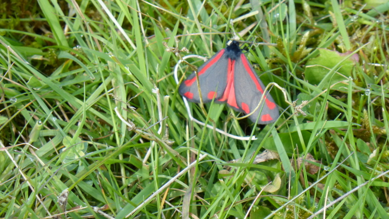
Fortunately the small numbers of butterflies seen on transects have been supplemented by some day flying moths including Burnet Companion, Mother Shipton and Latticed Heath (photos of which were attached to Update no 17) and, in the Peak District, the Speckled Yellow, and recently the Cinnabar moth has emerged (photo attached) to add some colour to the general countryside, especially at those sites that contain the much maligned ragwort plant, upon which this moth depends as it is the main foodplant of its caterpillar, the colour of which are bright yellow with black bands which warn predators that they are very distasteful!
Finally, it will probably not be too long before the first sighting of our most common butterfly is made in the County – namely the Meadow Brown followed by the almost equally abundant Ringlet. both of which were flying by the 9th of June in 2014.
Only your records will be able to confirm whether the above mentioned butterflies have emerged yet within the County – thanks again in anticipation of them!
Regards,
Ken Orpe